2024
UPCOMING EVENTS
|
April 18, 2024
6:15 pm AEDT |
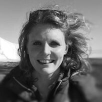
Monthly Meeting and GSAV AGM GSAV AGM 6.15pm followed by presentation Talk by GSAV Chair, Dr. Anne-Marie Tosolini Cretaceous – Cenozoic Floras from SE Australia Location: Face to Face meeting at Fritz Loewe Theatre, McCoy Building, cnr. Swanston and Elgin streets, University of Melbourne, Carlton VIC AGM Documents: Agenda GSAV Annual Report 2023-2024 GSAV Committee Nomination Form 2024-2025 If you are interested in a GSAV Committee Position in 2024, please complete and email this form, specifying your Committee nomination, no later than 17th April 2024 to gsavictoria@gmail.com. >>> Event starts at 5.30pm for drinks and nibbles, followed by the AGM at 6.15 pm then the presentation <<< Abstract
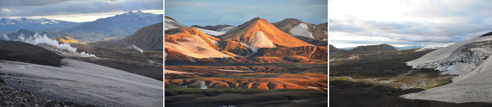
Three localities in Victoria reveal floras derived from different time slices through the Cretaceous, Paleogene and Neogene that give insights into the evolution of the vegetation, past ecosystems and climates of SE Australia. In the Early Cretaceous, large, volcanigenic, fluvial systems formed sedimentary successions up to 3 km thick in the Otway and Gippsland basins. Early Cretaceous (~125–100 Ma) plant macro and mesofossils collected from multiple stratigraphic sections were analysed within a sedimentological context to resolve plant facies associations. These associations reflect gymnosperm floras from within different upland and lowland ecosystems. Rare early angiosperms were restricted to wetlands. Paleogene floras from Anglesea brown coal (~37–34 Ma) reveal diverse ecosystems. Floras are predominantly angiosperm leaves that support a high diversity of insect feeding traces. Together, these tropical floras and inter-dependent plant-insect relationships reflect evolution of complex foodwebs in these high-latitude ecosystems during the late Eocene greenhouse climate. Miocene brown coal floras (~23–16 Ma) of the Morwell Formation, Latrobe Group, can be assigned to facies-controlled associations that reflect ecosystem development on a growing peat bog. Rare, well-preserved plant fossils within cyclic lithofacies in the brown coals were taphonomically analysed and illustrated. Facies progression reflects development of the peatland from fire-prone marsh to angiosperm-dominated, ombrogenous forested bog, and support recent palynological and sedimentological analyses. Floras represent ecosystem changes driven by substrate wetness during peatland aggradation and evolution of wetland/peatland systems through the early to mid-Miocene. Together, these three floras, from Cretaceous, Paleogene and Neogene ages, give critical insights into the evolution of Australia’s modern vegetation. Bio
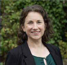
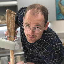
Dr Anne-Marie Tosolini completed a PhD in Palaeobotany at The University of Melbourne, then went on to postdoctoral research for 3 years at the University of Leeds and the British Antarctic Survey, Cambridge, U.K. She collected fossil plants in Antarctica and used them to interpret past forest ecosystems and associated climates. She returned to Australia in 2004 and worked at Latrobe University part-time for 5 years. She is currently Senior Lecturer in School of Geography, Earth and Atmospheric Sciences, at The University of Melbourne, where she has worked half-time for 14 years. She coordinates two first-year subjects: a broad-brush environmental subject and a basic geology course with a 3-day field trip. |
|
May 23, 2024
6:00 pm AEDT |
Monthly Meeting
Talk by Dr Andrew Gunn Aeolian sediment pathways on Mars Location: Face to Face meeting at Multipurpose Room 1 (Ground Floor), Kathleen Syme Community Centre, 251 Faraday St, Carlton VIC >>> Event starts at 5.30pm for drinks and nibbles, followed by the presentation at 6.00 pm<<< |
Abstract
Owing to a lack of recycling through tectonic processes, large sedimentary systems accumulate on Mars’ surface. Throughout its history, cratering has produced large amounts of sedimentary material. In past climates, fluvial processes carved canyons and laid down deltas. Today, active surface processes are largely gravity-driven, cryospheric, and aeolian. Despite a tenuous atmosphere, and frost covering sand for large periods of the year in high latitudes, aeolian activity on Mars is commonplace today. It hosts one of the largest dune fields in the Solar System, which circumscribes the north polar ice cap. This ice cap sits atop, and in places is interbedded with, a large aeolian sedimentary unit similarly as voluminous as the active dune field. At lower latitudes, dune fields are dotted throughout the landscape, often found accumulating within craters which act as sedimentary sinks. In this talk I will discuss our recent progress in understanding how these aeolian sediments are distributed and moved on Mars’ surface. I will contextualize and highlight our studies on aeolian sediments in craters (Gunn et al., 2022), around the north pole, and more broadly across the globe (Rubanenko et al., 2023; Rubanenko et al., 2022; Gunn & Jerlomack, 2022). These studies inherently make use of remotely sensed data; we employ a broad range of instruments onboard NASA spacecraft including HiRISE, CTX, SHARAD, and MOLA. These data are interwoven with theory, painstaking manual and automatic mapping of geologic and geomorphological features, and compared to global climate model and mesoscale simulations of Mars’ atmosphere. Together, these studies help us understand climate history, the atmospheric dynamics that contribute to geomorphic work, and the long-term evolution of sedimentary systems and how they are connected.
REFERENCES
Rubanenko, L., A. Gunn, S. Pérez-López, L. Fenton, R. Ewing, A. Soto, M. Lapôtre, 2023, Global surface winds and
aeolian sediment pathways on Mars from the morphology of barchan dunes, Geophysical Research Letters.
Rubanenko, L., M. Lapôtre, R. Ewing, L. Fenton, A. Gunn, 2022, A distinct dune-formation regime on Mars. Nature
Communications.
Gunn, A., L. Rubanenko, M. Lapôtre, 2022, Accumulation of windblown sand in impact craters on Mars. Geology.
Gunn, A., and D. Jerolmack, 2022, Conditions for aeolian transport in the Solar System, Nature Astronomy.
Bio
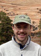
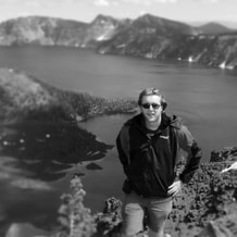
Dr. Andrew Gunn is a Lecturer in Physical Geography in the School of Earth, Atmosphere and Environment at Monash University. His research is focused on the physical processes that create planetary surfaces, specializing in deserts and Mars. Andrew was trained at the University of Melbourne (BS in Applied Mathematics), the University of Tasmania (Honours in Physical Oceanography), the University of Pennsylvania (PhD in Earth Science) and Stanford University (Postdoc in Geological Sciences). Andrew's research focuses on patterns that emerge from geophysical fluids. His main area of interest is typically called 'Physical Geography' or 'Process Geomorphology'. Dr. Gunn studies how planetary surfaces, particularly those made of sediment, coevolve with the flow of the atmosphere or liquids (oceans, lakes, rivers), and how external perturbations (e.g. climate change) may influence that coevolution. He uses a blend of research methods to answer these questions: field work, remote sensing, experiments, simulations and theory. Andrew researches Earth and other bodies in the Solar System, like Mars, Titan, Pluto and Venus.
PAST EVENTS
2024
|
March 21, 2024
6:15 pm AEDT |
Monthly Meeting and Selwyn Award Presentation
Talk by Dr Kevin Hill Structure and Tectonics of Cape Liptrap; some myths and new analyses Location: Face to Face meeting at Fritz Loewe Theatre, McCoy Building, cnr. Swanston and Elgin streets, University of Melbourne, Carlton VIC >>> Event starts at 5.30pm for drinks and nibbles, followed by the presentation at 6.15 pm<<< |
Abstract
The superb exposures around the Cape Liptrap peninsula have long been visited and debated by Victorian geologists and students. Along the east of the peninsula the Waratah Faulty is well exposed, juxtaposing deformed Early Devonian turbidites to the west and ?Cambrian volcanics overlain by Ordovician marls and dolomites and Early Devonian reefal carbonates to the east. The Early Devonian turbidites, along the west side of Cape Liptrap, are the youngest rocks deposited before middle Devonian arc-continent collision in the Lachlan orogen, a major continent building event in southeastern Australia.
New petrographic and geochemical analyses of the Cambrian volcanics (Bisits MSc 2023 and in prep) show that the southern suite is uniformly suprasubduction zone MORB, and the northern suite contains mafic to felsic, calc-alkaline island arc volcanics. The coarse grained serpentinites and pegmatitic gabbros between the suites are consistent with uplifted and dismembered ophiolite with local silicification to form chrome chalcedony. None of the rocks shows evidence of regional metamorphism. An issue is how this dismembered ophiolite sequence was brought into shallow water to allow unconformable deposition of the overlying Ordovician marls and reefal Devonian carbonates?
The Early Devonian turbidites were deposited in water depths of a few hundred metres, consistent with hummocky cross-stratification and a shallowing upwards sequence to conglomerates (eg Dyson 1996). The large-scale chevron folds in the early Devonian turbidites with weak cleavage and axial planar quartz veins are well known and are considered to have formed under low-grade metamorphism. However, the rocks record an early phase of deformation at shallow depths (Hill et al in prep; Liu MSc 2022, Phonsit MSc 2023). This deformation occurred whilst the sequence was still relatively soft and wet. The sandstones were competent and shortened by thrusting symmetrically both upwards and downwards. This resulted in symmetrical ramp anticlines, box-folds and antiformal stacks. At the same time the shales underwent plane strain shortening with no thrust faults. This was concurrent with dewatering such that the shales hardened leading to the onset of chevron folding. The early deformation is considered to have occurred at burial depths of ~3km and the chevron folding at burial depths of ~5 km.
Tectonically, in the Early Devonian, the Liptrap area was at the leading edge of an east-verging accretionary prism converging with an area of thickened oceanic crust, a remnant arc or oceanic plateau. No underlying continental Selwyn block is required. The Liptrap area was rapidly buried by a thick sequence of shallowing upwards turbidites that onlapped the accretionary prism and the ‘arc’. The collision zone propagated south, and sandstone thrusting associated with shale thickening occurred when the shales were weak at a depth of ~2-3km. The shales dewatered and hardened, and folding occurred at depths of 3-5 km, including emplacement of quartz veins at temperatures of ~150OC and depths of 5-7km.
Authors
Kevin Hill, Sandra McLaren, Eleanor Green, Catriona Bisits, Shuang Liu & Thiwa Phonsit. Geography, Earth & Atmospheric Sciences, University of Melbourne.
A few important REFERENCES.
Cayley R.A., Taylor D.H., VandenBerg A.H.M. & Moore D.H. 2002. Proterozoic – Early Palaeozoic rocks and the Tyennan Ororgeny in central Victoria: the Selwyn Block and its tectonics implications. Australia Journal of Earth Sciences 49, 225-254.
Dyson I.A. 1996. Significance of hummocky cross stratification and quasi-planar lamination in the Lower Devonian Walhalla Group at Cape Liptrap, Victoria. Australian Journal of Earth Sciences, 43: 189-199.
Gray, D.R., Janssen, C. & Vapnik, Y., 1999. Deformation character and palaeo-fluid-flow across a wrench fault within a Palaeozoic subduction accretion system: Waratah Fault Zone, southeastern Australia. Journal of Structural Geology 21 191-214.
Gray D.R. & Foster D.A. 1998. Character and kinematics of faults within a structurally thickened subduction-accretion system, Lachlan Orogen: implications for the tectonic evolution of eastern Australia. Journal of Structural Geology 20, 1691-1720.
Jansann C., Laube N., Bau M. & Gray D.R. 1998. Fluid regime in faulting deformation of the Waratah Fault Zone, Australia, as inferred from major and minor element analyses and stable isotopic signatures. Tectonophysics 294, 109-130.
Keetley J.T. 2005. 3D structural analysis of the Cape Liptrap area, an analogue for oilfield compartmentalization in Papua New Guinea. PhD thesis (unpublished), the University of Melbourne, Australia, 262 pages.
Keetley J.T., Hill K.C. & Nguyen C. 2001. Mesoscopic Fold and Thrust Structures at Cape Liptrap Victoria, Australia – A PNG Analogue? In Hill K.C. & Bernecker T. (eds) Eastern Australasian Basins Symposium, A Refocussed Energy Perspective for the Future. Petroleum Exploration Society of Australia Special Publication. P. 179-188.
Lennox, P. & Golding, S.D., 1989. Quartz veining in simply folded arenites, Cape Liptrap, southeast Victoria, Australia. Australian Journal of Earth Sciences, 36:243-262.
Bio
Dr. Kevin Hill is the GSAV 2023 Selwyn Award Winner. Kevin Hill is a structural geologist who has over 35 years’ experience in industry and academia. He is an Oxford graduate who worked for BP in Canada and London in their structural specialists group and completed a PhD on the PNG fold belt at the University of Melbourne. He taught at La Trobe and Melbourne Universities and consulted with many companies in Australia and SE Asia, working on seismic interpretation, balanced and restored cross-sections, 3D structural models for gold and gas exploration. Kevin now teaches courses in structure and basin resources, including CO2 and hydrogen storage, geothermal energy, water and hydrocarbons. He continues with fold-belt and basin margin research at the University of Melbourne.
|
Feb 29, 2024
6:15 pm AEDT |
Monthly Meeting
Talk by Dr Karen Chin “An Arctic marine ecosystem in the greenhouse world of the Late Cretaceous" Location: Face to Face meeting at Fritz Loewe Theatre, McCoy Building, cnr. Swanston and Elgin streets, University of Melbourne, Carlton VIC >>> Event starts at 5.30pm for drinks and nibbles, followed by the presentation at 6.15 pm<<< |
|
Abstract
What do we know about polar marine ecosystems in a warm greenhouse world? In the Late Cretaceous, Arctic marine organisms experienced warmer temperatures than those of today, but still contended with seasonal extremes in photoperiod. Different types of fossil evidence have been recovered from Cretaceous localities on Devon Island in the Canadian High Arctic. Glauconitic greensands, planktonic microfossils, fossil invertebrates, extinct vertebrates, ancient wood, abundant coprolites, and geochemical analyses shed light on the structure of a productive polar paleoecosystem and reveal trophic interactions between some members of the ancient marine community.
2023
|
Nov 23, 2023
6:00pm AEDT |
🎄 GSAV End of Year Celebration 🎄
Talk by Dr Susan White Geology's place in the natural history of Victoria; Sites of Geological Significance, Geoheritage and Geotourism. Location: Face to Face meeting at Multipurpose Room 1 (Ground Floor), Kathleen Syme Community Centre, 251 Faraday St, Carlton VIC |
|
Abstract
The place geoheritage has in the natural heritage of Victorian and the role that GSA(V) plays in this work is often underestimated. The GSA(V) maintains a state wide database of sites of geological significance. The procedures for assigning and reviewing sites and the issues regarding appropriate management of sites are discussed. Geotourism is increasing but not all sites of high significance are suitable due to access, safety and site vulnerability issues. Examples of some of the interesting geoheritage sites on the Newer Volcanics, Buchan, the Victorian Goldfields and areas around Melbourne are discussed. Bio
Susan is a karst geomorphologist specialising in the evolution of karst landscapes but she has also a long standing interest in geological heritage. She has chaired the Geoheritage subcommittee for the Victorian Division for many years and manages the database of sites of significance for Victoria. She chaired the Federal Standing Committee between 1996 – 2010. She has been on the GSAV Division committee for many years mainly as the geoheritage sub-committee chair. |
|
Oct 26, 2023
6:00pm AEDT |
Melbourne Museum Collection Tour
Private tour led by Oskar Lindenmayer & Rolf Schmidt Location: Melbourne Museum (meet at front plaza) Time: 6.00pm - 7.30pm Limited to 28 visitors (split into 2 groups). |
|
Aug 31, 2023
6:00pm AEST |
Monthly Meeting & GSAV Awards Ceremony
Talks by Mana Ryuba and James La Greca (Melb Uni) I) Synsedimentary breccias in the Teena Dolomite: evidence of extensional Tectonics in the Proterozoic McArthur Basin II) Earthquake environmental effects and Bayesian analysis of ground motion models using chimney fragility curves, 2021 Mw 5.9 Woods Point earthquake, southeast Victoria, Australia Location: Fritz Loewe Theater, Earth Science Building, Melbourne University AbstractS
I) The Proterozoic McArthur Group sediments are host to giant “SEDEX” type Pb-Zn deposits. Undescribed breccias in the uppermost section of the Teena Dolomite Member underlie the Barney Creek Formation, which hosts the renowned McArthur River (HYC) Pb-Zn-Ag deposit. The breccias display complex textures, but are largely monomict, minimally transported breccias which appear to have formed from the fragmentation of the Teena Dolomite. Sedimentological and petrographic analysis reveals that fractures and breccias are synsedimentary in origin. The breccias and fractures contain fibrous marine cements and sediments from the overlying Barney Creek Formation, indicating fracturing was syndepositional with the Teena Dolomite and the early Barney Creek Formation. Spatial analyses show that the breccias and fractures are widely distributed throughout the Batten Fault Zone. The breccias appear to have a tectonic origin. Considering this, an extensional tectonic model is proposed for the large-scale brecciation of the Teena Dolomite. Results from this study contribute to improving our understanding of ore deposit models and stratigraphic targets for future Pb-Zn exploration in the McArthur Basin. II) Moderate-to-large crustal Australian earthquakes offer opportunities to investigate the spatial dimensions of earthquake environmental effects (EEEs) in slowly deforming continental interiors. They also provide opportunities to assess the performance of ground motion models that are fundamental constituents of the Australian national seismic hazard model. The Mw 5.9 Woods Point earthquake is the first strike-slip earthquake to be investigated using EEEs in Australia. The scarcity of near-source instrumentally-recorded ground motions and “felt” reports has made assessment of ground motion models difficult. EEEs were surveyed and categorised using the Environmental Seismic Intensity Scale. EEEs identified following the earthquake suggest lower than expected ground motions within the epicentral region and show asymmetry in their intensity distribution. There is evidence for EEEs produced through high structural vulnerability of weak geomorphic elements (e.g., rockfalls from susceptible cliffs and road collapses in areas of prior landslide activity) and evidence for a lack of EEEs in other areas, despite potentially vulnerable elements. There were no observed primary EEEs (i.e.. surface rupture). It appears as if the strikeslip kinematics of the fault rupture, and ca. 4 km depth of the source fault, resulted in a halo of low seismic shaking immediately proximate to the source fault (i.e., with ca. 5- 8 km). A Bayesian approach was used to evaluate the performance of commonly used ground motion models within southeast Australia using observed earthquake damage to chimneys (and non-damage) and chimney fragility curves. Relative performance of ground motion models in the near-field of the Woods Point earthquake is generally consistent with pre-earthquake expert elicitation-based hierarchical rankings of models developed for the Australian National Seismic Hazard Assessment in 2018, although individual ground motion model weightings vary significantly. Ground motion models could be refined in future national seismic hazard models for Australia. BioS
I) MANA RYUBA is a recent geology graduate from the University of Melbourne, having completed a Bachelor of Science degree with Honours in 2023. Her Honours project was supervised by Associate Professor Malcolm Wallace and Dr. Ashleigh Hood. She worked on Paleoproterozoic sedimentary rocks from the McArthur Basin. Mana was previously a committee member of the GSAV between 2021-2023, in her role as the student representative for the University of Melbourne. II) JAMES LA GRECA is a PhD researcher in Earthquake Geology at the University of Melbourne. He also works a day a week at the Seismology Research Centre. His research focuses on the Alpine Fault plate boundary in New Zealand, as well as Australian earthquakes. He is interested in long-term slip rates, as well as complex fault interactions at fault junctions with the Marlborough fault system. James received his Bachelor of Science degree in Geology from the University of Melbourne in 2020. He then completed his Master of Science degree in Earth Science at the University of Melbourne in 2022. His master's thesis examined the Mw 5.9 2021 Woods Point earthquake felt in Melbourne under the supervision of A/Prof Mark Quigley. James is passionate about understanding the seismic hazard posed by both the Alpine Fault and Australian earthquakes. He believes that his research can help to mitigate the risks of earthquakes both countries. He is also excited about the potential for his research to improve our understanding of plate tectonics and fault behaviour. |
|
July 27, 2023
6:00pm AEST |
Monthly Meeting
Talk by Dr Jessica Hamilton (ANSTO) Earth and Environmental Science at the Australian Synchrotron Locations 1) Face to Face in Carlton Activity Room 2 (upstairs), Kathleen Syme Community Centre, Faraday St, Carlton VIC Talk will be preceeded by drinks & nibbles from 5:30pm. Please note that on-street parking is usually easily available around the venue at this time. 2) Online via Zoom Abstract
ANSTO’s Australian Synchrotron is a particle accelerator which produces extremely powerful light that is used by a range of analytical techniques. For example, X-rays are used to measure the chemistry of elements, including their oxidation state and how they are bonded to nearest neighbour atoms. X-rays are also used to create high resolution maps of elemental distribution and chemistry, and to detect trace minerals that cannot be found using conventional methods. This talk will introduce a number of these capabilities and highlight examples of their application within Earth, Environmental, and Agricultural sciences. Bio
Dr Jessica Hamilton is a beamline scientist at the Australian Synchrotron’s X-ray Absorption Spectroscopy (XAS) beamline. Dr Hamilton uses these advanced analytical techniques to understand geochemical processes in mine tailings as they weather or as they are subject to various treatments. In particular, her research focusses on utilising ultramafic tailings for carbon capture and critical metal recovery. She completed her PhD in 2018 at Monash University in environmental geochemistry and mineralogy, with her thesis investigating the fate of transition metals during mineral carbonation of mine tailings. Her research has attracted awards and grants including from the Mineralogical Society of America, Australian Institute of Mining and Metallurgy (AusIMM), and the Mineralogical Society of Great Britain & Ireland, and in 2020, Jessica was the Australian Winner of the Falling Walls Lab for innovative ideas. Jessica is also the President of the Australian X-ray Analytical Association (AXAA) which represents the national X-ray and neutron science community. |
|
May 25, 2023
6:00pm AEST |
Monthly Meeting & AGM
Talk by Dr Laurent Ailleres (Monash University) Loop - an interoperable, integrative, probabilistic 3D geological modelling platform Location: Face to Face meeting at Activity Room 1, Kathleen Syme Community Centre, Faraday St, Carlton VIC Talk will be preceeded by drinks & nibbles from 5:30pm. Please note that on-street parking is usually easily available around the venue at this time. Abstract
With the current need for critical metals (including Cu), the ability to be predictive undercover and to improve mining of known resources, requires the ability to better predict sub-surface geology at multiple scales. Geologically consistent mine models should equate to better resource models and consequently a more economical way of producing the required resources for a greener future with increased recovery rates and reduced number of resources required and waste produced. We present the current state of the Loop project, an open-source interoperable, integrative, probabilistic 3D geological modelling platform. We have implemented the use of all structural geological data (e.g., fault kinematics, fold axial surfaces, fold axes, deformational overprinting relationship) in the modelling process. We have automated the building of 3D geological models from geological survey served geological data including automatic geological map topological analysis and geological history building. As a proof of concept, users can now draw a polygon on a map and generate 3D models in just a few minutes using the map2loop and LoopStructural libraries (github.com/Loop3D). We are integrating geophysical constraints and modelling as early as possible in the modelling workflow. Model uncertainty is characterised and an integral part of the modelling process. The main outcome of the development of the structural modelling method (LoopStructural) is the definition of structural frames which allow the definition of a curvilinear and conformable to layering, rectangular coordinate system throughout the models. We present the concept for LoopResources, the property modelling library for the Loop platform. Using this deformed cartesian coordinate system, we propose to adapt geostatistical and interpolation methods to curvilinear coordinate systems using classical approaches of UVW transformations. This will ensure that lithological anisotropies are enforced during resource estimation and property modelling. Loop is a OneGeology initiative, initiated by Geoscience Australia and funded by Australian Territory, State and Federal Geological Surveys, the ARC and the MinEx CRC with the participation of BHP, Anglo American and GSWA. The project is led by Monash University and involves research groups from the University of Western Australia, the RING consortium at the Universite de Lorraine, Nancy, France and RWTH Aachen in Germany. In-kind research is also provided by Natural Resources Canada (Geological Survey of Canada), Geoscience Australia and the British Geological Survey. Other partners include AuScope and the USGS Bio
Initially trained as a structural geologist, Laurent was awarded his PhD in 1996, in structural geology, having worked in the French Alps and from an office only meters away from the development of the Gocad 3D modelling package. Since 1996, he has been a research fellow at Monash University. Laurent is interested in the evolution of tectonic processes through time and their effect on multi-scale mineralisation processes. He specialises in structural geology and geophysics as well as multi-scale 3D geological modelling applied to tectonics and minerals exploration. He teaches field mapping at undergraduate level in poly-deformed metamorphic terranes and advanced structural mapping and structural geophysics at postgraduate level. His geological experience spans multiple scales across Africa, Europe, Australia and the Americas. He leads the Loop initiative to develop the next generation of 3D geological and geophysical modelling tools and champions structurally-ruled probabilistic geological modelling. Laurent is also the managing director of PGN Geoscience Pty Ltd, a small consulting company providing services to the minerals exploration and mining industries, from global scale project generation to litho-structural interpretations of geophysical data, to smaller-scale structural analysis of mineralisation controls at the deposit scale. |
|
June 22, 2023
6:00pm AEST |
RSV / GSAV Howitt Lecture 2023
Talk by Prof Andrew Mackintosh (Monash University) Glaciers and ice sheets in a warming world Location: Online & in-person at the Royal Society of Victoria (RSV), 8 La Trobe Street, Melbourne Abstract
Glaciers have experienced near-universal retreat during the last century. Mass loss from the massive ice sheets in Antarctica and Greenland is accelerating, and glaciers and ice sheets are now the largest contributor to sea level rise. Retreating glaciers also threaten water supplies and are linked to mountain hazards. While ice seems distant to us in Australia, a 2014 report by the Climate Council indicated that $226 billion dollars of our infrastructure is located within 1.1 m of sea level and is at risk of inundation by the end of this century under high-emission climate change scenarios, with ice melt being a major source of risk. Globally, sea level rise poses an existential risk to low-lying islands, major deltas, and coastal megacities. The science of glaciology is far from settled – our ability to measure and simulate how ice is changing has improved dramatically - but future predictions of glacier and ice sheet contributions to sea level change remain challenging. I will describe our work to reconstruct past glacier and ice sheet changes and improve predictions, illustrated with field work photos and video from the Southern Alps of New Zealand and Antarctica. Bio
Professor Andrew Mackintosh is Head of the School of Earth, Atmosphere and Environment at Monash University, and is a Chief Investigator of the Australian Research Council Special Research Initiative ‘Securing Antarctica’s Environmental Future’. His research aims to improve our understanding of glacier and ice sheet response to climate change, including assessing the impacts on sea level, water resources and ecosystems. He is a regular commentator in the media and was a Lead Author of the IPCC Special Report on the Oceans and Cryosphere in Changing Climate published in 2019. Andrew’s work has taken him to the world’s major mountain ranges as well as the ice sheets of Antarctica and Greenland. He has a PhD from the University of Edinburgh, a post-doc from Utrecht University, and he has held visiting positions at Columbia University and The University of Bristol. Prior to Monash, he was Director of the Antarctic Research Centre in Wellington, New Zealand. |
|
Apr 27, 2023
6:00pm AEST |
Monthly Meeting
Talk by Dr Juliet Sefton (University of Melbourne) Mangrove sediments as geological archives for reconstructing Holocene sea level Location: Zoom Meeting Abstract
Geological reconstructions are key to extending the observational record (satellites and tide gauges) of sea-level change. Extending this record is necessary to examine the climatic and geophysical drivers of sea-level change on centennial to millennial timescales. Mangrove sediments, which accumulate in the intertidal zone, can be used to reconstruct local (relative) sea-level change in (sub-)tropical regions. In this seminar, I will present some recent work in the Federated States of Micronesia in the western Pacific Ocean, where mangrove sediments provide a record of relative sea-level rise over the past ~5000 years. This rise is anomalous in the region, and has implications for geophysical processes, as well as for archaeological models of human settlement across Oceania. Bio
Dr Juliet Sefton's research focuses on how geological records of sea-level changes can be used to reconstruct past ice sheet behaviour and environmental change over the Quaternary and beyond. Juliet uses field observations in combination with palaeontology, sedimentology, geochemistry, and geochronology. Prior to joining Monash University, Juliet was a postdoctoral researcher at Tufts University, USA. |
2022
PAST EVENTS
|
Nov 24, 2022
6:00pm AEDT |
Monthly Meeting
Talk by Dr Verena Korasidis (University of Melbourne) Tiny but mighty; insights from fossil pollen about future climate change Location: Zoom Meeting & face to face meeting at Activity Room 1, Kathleen Syme Community Centre, Faraday St, Carlton VIC Talk will be preceeded by drinks & nibbles from 5:30pm. Please note that on-street parking is usually easily available around the venue at this time. Abstract
The current rapid increase in atmospheric CO2 concentrations has already exceeded the range ofatmospheric and climatic conditions that have existed for the last 2.5 million years. Past hyperthermal events, such as the Paleocene-Eocene Thermal Maximum (PETM), are considered the best analogues to elucidate changes in past floral diversity and distribution, as well as to predict future behaviour and extinction risk of plant assemblages. The PETM (~56 Ma), was characterized by rapidly and elevated concentrations of CO2 to the atmosphere, and increased temperatures and precipitation across mid-paleolatitudes, which affected biotic assemblages and distributions. Plant megafossils from the PETM in the Bighorn Basin, north-central Wyoming, USA, document a dramatic shift in floral composition, whereas palynofloral change from the same sections has appeared to be more subtle. This talk will explore this discrepancy, presenting new evidence from pollen preservation and measures of the stable carbon isotope composition of specific pollen taxa. Through examining differences in preservation and isotopic composition, extensive redeposition of older pollen grains during the PETM is identified. Importantly, the exclusion of reworked palynotaxa from analyses reveals that, as in the megaflora, temperate taxa were absent during the PETM at the time when dry tropical taxa briefly appeared. Major climate changes like the PETM may commonly destabilize landscapes, increase reworking, and thus smooth patterns of change in microfloras, leading to underestimates of the rate and magnitude of floral response to past global change. Bio
Dr Vera Korasidis is an Elizabeth and Vernon Puzey Fellow and Lecturer in the School of Geography, Earth and Atmospheric Sciences at the University of Melbourne. Prior to this she was a Postdoctoral Fellow at the National Museum of Natural History, at the Smithsonian Institution in the United States. Her research seeks to improve our understanding of floral response to warm climatic events through the Cenozoic that may provide a deep time analogue for future climate change. To investigate this she integrates palynology, stratigraphy, sedimentology and geochemistry in both field and lab work. |
|
Oct 27, 2022
6:00pm AEDT |
Abstract
The Critical Element tellurium is a very rare element, with a concentration of only 1 part per billion in Earth’s crust. It is both toxic and unevenly distributed through the environment, with highest levels (up to wt%) found in some gold deposits. Despite its rarity, tellurium has complex geochemical behaviour in the oxidation zone, involving four oxidation states and a variety of bonding environments. Tellurium is becoming important in the solar panel industry, with a growing portion (currently 5-10%) of solar panels containing tellurium in the form of cadmium telluride. However, tellurium is seen as a penalty element in gold and copper mining and it is only inconsistently recovered as a by-product, leading to supply chain uncertainty. At least 10 times more tellurium goes to mining waste every year than is used in tellurium-containing products. Understanding tellurium biogeochemistry is important to ensure that tellurium does not become a future contaminant of concern. Field studies of tellurium biogeochemistry show that both microbial and chemical interactions with elements such as iron and gold govern tellurium cycling. Only some microbes are able to tolerate the high concentrations of tellurium that exist in the weathering zone of tellurium-rich mines. This improved understanding of tellurium biogeochemistry allows us to propose new ways to recover both gold and tellurium simultaneously using either hydrothermal or microbial treatment. Immobilisation of tellurium in mining or anthropogenic waste may be most effective using iron oxides. More broadly, it is important to understand the (bio)geochemistry of all Critical Elements throughout their lifecycle both to provide insights on their processing, and to prevent contamination; challenges which will help to define the 21st Century. Bio
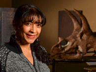
Owen Missen is a Critical Elements researcher who has recently completed his PhD thesis (accepted) at the Monash University School of Earth, Atmosphere and Environment & Museums Victoria Geosciences. His thesis focuses on tellurium biogeochemistry, including a review, field study of tellurium biogeochemistry in Mexico and microanalysis of weathering zone minerals. He is currently undertaking a cobalt biogeochemistry project as a Geosciences Researcher at Museums Victoria. |

|
Sep 29, 2022
6:00pm AEST |

Monthly Meeting
Talk by Dr Dennis Arne (Telemark Geosciences) Gold Exploration in Victoria: Renaissance, Resurrection, Replay? Location: Zoom Meeting Abstract
Gold exploration in Victoria has seen a resurgence in the last few years after several decades of minimal expenditure at the beginning of the millennium (the Resurrection). This dramatic increase in exploration expenditure was driven largely by the discovery and then mining of the Swan Zone at Fosterville, making it one of the most profitable gold mines globally. The recent phase of exploration has been informed by several decades of research by various universities, federal organisations and the Geological Survey of Victoria that have constrained the timing, tectonic setting, structural controls, and hydrothermal alteration associated with gold deposits in central Victoria (the Renaissance). These studies have demonstrated that the Fosterville deposit represents a distinct style and timing of gold mineralization that was previously considered to be of marginal significance. Despite this, significant effort has been extended exploring for classical gold mineralization typical of the Ballarat mineralogical domain (the Replay). This presentation summarises some of the recent concepts relevant to the genesis of gold deposits in Victoria, reviews (somewhat) recent advances in our understanding of gold mineralization and examines a few of the more interesting exploration projects currently underway Bio
Dennis Arne has 40 years experience in geology and applied geochemistry globally. He has overseen regional geochemical exploration programs in the Yukon, British Columbia, Nunavut and northern Quebec in Canada, the USA, eastern Australia, Suriname, Sudan and Laos. He was Managing Director and Principal Consultant - Geochemistry of CSA Global Canada until late 2017, General Manager and Principal Consultant – Geochemistry for Revelation Geoscience (purchased by CSA Global in 2012), Principal Consulting Geochemist with ioGlobal (now Reflex Geochemistry) and formerly Senior Geochemist with Geoscience Victoria (now Geological Survey of Victoria, Australia). Dennis is currently director and principal consulting geochemist at Telemark Geosciences and was until recently Director of Exploration for E79 Resources. He is a Fellow and former President of the Association of Applied Geochemists, is a Member and a Registered Professional Geoscientist (Geochemistry) of the Australian Institute of Geoscientists (#10064), and a registered Professional Geoscientist in British Columbia, Canada (#34686). |
|
Aug 25, 2022
6:00pm AEST |
Monthly Meeting
Talk by Dr Mark Warne (Deakin University) Tracking ocean current history and deep time faunal migrations: Case studies from the Cenozoic fossil record of SE Australia Location: Zoom Meeting Abstract
Bass Strait has its origins in the late Cretaceous but only became a fully open marine link between the Pacific and Southern oceans during the late Oligocene. A significant aspect of the evolution of this seaway since the Miocene has been the development and interplay of surface currents such as the East Australian Current, Leeuwin Current and Antarctic Circumpolar Current. These, and other ocean currents, have influenced marine faunal migrations, and substantially shaped Bass Strait marine biodiversity. These oceanographic events have also left distinctive biostratigraphic markers within Cenozoic marine strata of SE Australia. For example, occurrences of shallow marine benthic microfossils, such as various epiphytal Ostracoda, have provided proxy evidence for changes in Bass Strait surface ocean circulation during the Miocene. The original dispersal mechanism for these abundant benthic microfossils was via attachment to seaweed, ripped up from shallow marine environments by coastal storms, and sent drifting vast distances across open oceans on surface currents, until colonization occurred in new shallow marine realms. However, ocean currents aren’t the only mechanism for the global dispersal of marine invertebrate clades. For instance, fossil evidence coupled with molecular clock studies, suggest that pelagic seabirds such as Shearwaters (Muttonbirds) played a role in the Pliocene migration of some marine invertebrates into the Bass Strait region. Bio
After initially training as a geologist, Mark Warne’s main work has been university teaching in the disciplines of geology, physical geography, palaeobiology and environmental science. He is the course director for the Bachelor of Science at Deakin University. He has research interests in the fields of marine micropalaeontology, palaeoceanography and sedimentary geology. A particular focus is the study of microfossil Ostracoda as proxy records of palaeoenvironmental change. He is currently the secretary for the International Research Group on Ostracoda (IRGO). |
|
July 28, 2022
6:15pm AEST |

Monthly Meeting | Hybrid Event
Talk by Dr Anindita Samsu Fractures and their ancestors: The multi-scale expressions and mechanisms of structural inheritance Location: Activity Room 2, Kathleen Syme Community Centre in Faraday St, Carlton Abstract
The outermost layer of the Earth’s crust can break, or fracture, due to large tectonic and non-tectonic forces. When fractures are connected to each other, they allow fluids to move within and across different levels of the crust. These fluids carry the heat and minerals that are required to form geothermal and mineral systems. Fractures are also responsible for earthquakes and rockfalls, which means that mapping their distribution and orientations is important for assessing natural hazards. The largest fractures on Earth are faults and fracture zones near the edges of tectonic plates. However, fractures are also found in the interiors of continental plates, where they commonly coincide with older weak zones. In this presentation, I will discuss the various ways in which the properties of older structures are “inherited” by younger fractures, including faults, joints, and dykes. Our research on the onshore Gippsland Basin of southeast Australia reveals how pre-existing structures in basement rocks can impact fracture orientations and distribution in the overlying cover rocks. By combining observations from drone and satellite imagery, bathymetry, potential field geophysics, and field measurements, we found that this relationship is scale-dependent, highlighting the advantages of using a multi-scale dataset for fracture analyses. We also invoked strain re-orientation – a mechanism for structural inheritance that is less often discussed than reactivation – to explain the obliquity of rift-related faults with respect to the inferred regional extension direction. More effort towards understanding the various expressions and mechanisms for structural inheritance will help us to: (1) recognise the influence of basement where reactivation is not evident, and (2) identify the spatial and genetic relationships between deep and shallow structures. These insights can be useful for inferring fluid transport pathways across different depth levels of the crust. Such advances can also support the earthquake hazard assessment by identifying potential links between surface ruptures and deep structures. Bio
Dr. Anindita Samsu is a geologist Research Fellow at Monash University. She completed her PhD in structural geology at Monash University in 2019. Prior to that, she studied Applied Geosciences at the University of Leoben (Austria) and completed an exchange semester at the Colorado School of Mines (USA). Anindita investigates cracks (a.k.a. fractures) in the Earth’s outer shell, which form when tectonic plates collide or are pulled apart. She uses a variety of tools to understand how the Earth’s crust has deformed over time at multiple scales, combining drone-based digital photogrammetry, traditional field mapping techniques, and geophysical data interpretation. Her field-based hypotheses are tested using analogue experiments, which involve scale models made up of sand, silicone, modelling clay, and syrups. Anindita recently joined the seventh cohort of Homeward Bound, a global leadership initiative and network of women in STEMM working towards a better outcome for society and the planet we share. |
|
June 23, 2022
6:00pm AEST |
2022 Howitt Lecture
Talk by Professor John Webb Australian Caves: Diversity, Wonder and Risk Location: Hybrid Meeting at the Royal Society of Victoria Abstract
The Australian continent is not well-endowed with caves on a world scale, but Australian caves are notable for their diversity (greater than any other area of equivalent size on Earth), which reflects variety in carbonate rock types, climate, vegetation and geological history. Australian karst has something for everyone, from the razor-sharp towers of north Queensland to the cold, deep shafts of southwest Tasmania, the carbonate dunes of southwest Western Australia, the clear cenote lakes of southeastern South Australia and the ancient reefs of northwest Western Australia. Australian caves are wonderful, both in terms of their visual impact and their scientific importance. They contain bat colonies that consume hundreds of kilograms of insects each night, a globally exceptional invertebrate fauna, vertebrate fossils that record animals and environments for at least the last 25 million years, and calcite speleothems that preserve detailed records of past climates. And Australian caves have risks. There are inherent dangers in exploring caves, including cold, heat, falls and getting stuck, but there are very few accidents in Australian caves because organised trips must have an experienced leader and appropriate equipment. Some caves themselves have been at risk from overuse and threats like limestone quarries. Bio
Professor John Webb is Professor of Environmental Geoscience at La Trobe University. His geomorphological interests centre on karst, and he is principal editor (with Susan White and Garry K. Smith) of Australian Caves and Karst Systems, in the book series Cave and Karst Systems of the World, soon to be published by Springer. He also works on tectonic geomorphology and the interaction between landscape evolution and human settlement, and he has studied the geomorphology of archaeological sites in Australia, Jordan, China, Papua New Guinea and New Caledonia. In addition, he specialises in groundwater and contaminated site management, with on-going research projects on improving treatment procedures for acid mine drainage and on the influence of climate and land-use change on groundwater. |
|
May 26, 2022
6:00pm AEST |
Online Meeting
Talk by Dr Tim Ziegler Make Emblems Kool Again: Electing The State Fossil of Victoria, Koolasuchus cleelandi Location: Zoom Meeting (registration required) Abstract
State emblems epitomise and celebrate the natural history of their region. They foster civic pride, are used to promote external tourism, and are at times a vital tool in conservation. Since 1995, four Australian states have selected official Fossil Emblems, alongside traditional flora and fauna. In 2021, Museums Victoria developed and enacted a campaign for Victoria to choose its own state fossil. Eight candidates representing the expansive geological and biological scope of Victoria’s fossil heritage were put to a popular vote. Campaign content including new specimen photographs, design graphics, and taxon profiles formed educational content to highlight each candidate’s unique character. ‘Champion’ videos from museum staff presented scientific narratives in a relatable, accessible register, and compelled the public audience to join in the campaign as active participants. Like so much in the recent period, the campaign character was also influenced by COVID-19, and ultimately ran entirely remotely online, from October to December 2021. Presence in traditional news media, museum channels, school classrooms, and organic social media contributed to a high level of engagement, with over 11,000 votes in total cast. Among a field of candidates including one of the world’s earliest land plants, a fierce ancestor to modern giant whales, and enigmatic Ice Age megafauna, it was announced in January 2022 that the Victorian public selected the Early Cretaceous amphibian Koolasuchus cleelandi to become Australia’s latest Fossil Emblem. This intriguing aquatic predator offers a suite of scientific characteristics to demonstrate key evolutionary principles, motivate education in science, inspire citizen participation in research, and uphold geological conservation. In this talk, I will outline the civic context that led Victoria to welcome its Fossil Emblem, present how the emblem campaign developed, and introduce Koolasuchus and its presence in polar Cretaceous Australia. An early look will also be given at the emblem’s future: with newly developed assets for outreach and scientific communication, along with pending additions to its hard-won, intriguing fossil record. Earth’s magnetic field is generated by convective movement of liquid iron in the outer core of the planet, about 3000 km below our feet. Around the planet, it creates an invisible shield called the magnetosphere that protects us and our technologies from an incoming stream of damaging charged particles from the sun and from outside the solar system. At the surface of the planet, the Earth magnetic field enables navigation in some species like birds and turtles, and people using compasses and smart phones--each device has a built-in magnetometer to sense the direction it is pointing. Bio
Tim Ziegler is the Vertebrate Palaeontology Collection Manager at Melbourne Museum. He oversees the protection, access, and care of over 250,000 fossil vertebrates, plants, and microfossils within the State Palaeontology Collection. Prior to this, he worked as a laboratory technician in palaeontology and completed a BSc (Hons) in 2017 assessing methodological reliability in vertebrate taphonomy. In 2015 he received the Frank Canavan Award from GSA Victoria. He is experienced in the retrieval, preparation, and conservation of vertebrate fossils, and passionate about illuminating fossil heritage for regional communities across Victoria. He is currently undertaking the survey and retrieval of Pleistocene vertebrate fossils from the east Gippsland karst, in collaboration with Parks Victoria and the Victorian Speleological Association. |
|
April 28, 2022
6:00pm AEST |
Online Meeting
Talk by Dr Agathe Lise-Pronovost (The University of Melbourne) Australia's vantage point on Earth magnetic field history Location: Zoom Meeting (registration required) Abstract
The Earth’s magnetic field is generated by convective movement of liquid iron in the outer core of the planet, about 3000 km below our feet. Around the planet, it creates an invisible shield called the magnetosphere that protects us and our technologies from an incoming stream of damaging charged particles from the sun and from outside the solar system. At the surface of the planet, the Earth magnetic field enables navigation in some species like birds and turtles, and people using compasses and smart phones--each device has a built-in magnetometer to sense the direction it is pointing. We often illustrate the Earth’s magnetic field as a giant bar magnet and this approximation is reasonable over geological timescales, but it does not apply at the ‘human-timescale’. We know from four hundred years of direct measurements by ground observatories, navigators and most recently, satellites, that the Earth’s magnetic field undergoes significant changes through time and from one region to the next. To learn how the Earth’s magnetic field changed further back in time and prior to instrumental data, we study geological materials such as volcanic rocks, marine and lake sediments and stalagmites. In this talk, I will present recent research aimed at reconstructing the Earth’s magnetic field history using geological materials from Australia. We will discuss the first Australian evidence for the Laschamp geomagnetic excursion, a period of global instability of the geomagnetic field which occurred 41,000 years ago and is recorded in Tasmanian lake sediments. We will then discuss a high-resolution record of the last 4,200 years derived from southwest Australian stalagmites. This data from Australia contributes to overcome the uneven distribution of paleomagnetic records around the globe, supports the next generation of data-driven geomagnetic field models, and drives the development of regional paleomagnetic dating for a continent with a rich Indigenous past. While the Earth magnetic field is useful to today’s society, paleomagnetic research helps understand how it changed in the past and how it may impact our future. Bio
Dr Agathe Lise-Pronovost is an expert in Earth magnetic field research working in the disciplines of Geochronology, Paleoclimate, and Archaeological Sciences. She is currently McKenzie Fellow in the School of Geography, Earth and Atmospheric Sciences at The University of Melbourne. Prior to this, she was Research Fellow in Archaeomagnetism at La Trobe University and she holds a PhD in Oceanography from the University of Quebec (Canada). Her research unlocks data from the past in materials such as lake and marine sediments, cave deposits, archaeological artifacts and lava flows to understand geomagnetic changes. She reconstruct the Earth magnetic field history, develop dating tools and engage in multi-disciplinary investigations. |
|
April 21-22, 2022
|
VUEESC
Victorian Universities Earth & Environmental Science Conference Calling all undergraduate and postgraduate students from across the Earth Sciences spectrum - the conference you didn't know you were waiting for is here! Venue: Monash University (Clayton Campus) Abstract submission deadline: March 31, 2022 |
|
March 31, 2022
6.00pm AEDT |
Online Meeting
Talk by Liz Mahon (University of Melbourne) 3D seismic geomorphology of the Early Cenozoic incised channels, Gippsland Basin, SE Australia: Evidence for submarine origin Location: Zoom Online Meeting Abstract
The Gippsland Basin has been a dominant feature in the geologic history of Victoria. As a result of extensive coal and hydrocarbon accumulations, it has experienced significant industry focus since the 1800’s. Our understanding of the basin has evolved over this time, as more data is acquired, and our understanding of geologic processes improves. Integral to the Gippsland Basins economic success is the coal- and hydrocarbon-bearing Latrobe Group, which consists of stacked shoreface and coastal plain deposits, cut by large, incised channels. These channels, termed the Marlin and Tuna Channels, incise over 500 m into the underlying Latrobe Group shoreface deposits. They are conspicuous on seismic intersections and have previously been interpreted as forming via fluvial incision associated with basin inversion/compressional tectonics. Recent seismic and well log analysis of extensional and compressional structures in the Gippsland Basin has revealed the onset for compressional tectonics occurred later than previously thought – at the Eocene-Oligocene transition. Biostratigraphic data indicates channel formation predates the onset of compressional tectonics in the Gippsland Basin. If compressional tectonism didn’t drive subaerial channel incision, then by what process did these enigmatic, large, incised channels form? Using used detailed 3D seismic interpretation, well log, and core, the origin of these channel systems has been re-evaluated. Bio
Liz Mahon is a stratigrapher/sedimentologist at the School of Geography, Earth and Atmospheric Sciences, University of Melbourne. She recently completed her PhD on the stratigraphic and structural evolution of the Late Cretaceous to Miocene interval of the Gippsland Basin. Prior to this she worked for Chevron in the Australia Business Unit for 8 years, in Development, Operations, and Exploration roles. Liz is currently working as a lecturer in Sedimentology at the University of Melbourne. Liz was awarded the GSV Postgraduate Research Grant in 2019. |
|
Feb 24, 2022
6.00pm AEDT |
Online Meeting
Talk by Dr Simon Barker Victoria University of Wellington, Te Herenga Waka The violent eruption of Hunga volcano, January 2022: Context, key features and ongoing activity Location: Zoom Online Meeting Abstract
On the evening of Saturday 15th January, a volcano in Tonga called Hunga-Tonga-Hunga-Ha'apai produced an eruption that was so large it generated a shockwave that travelled around the world, three times. The eruption produced a tsunami that had devastating impacts on many Tongan Islands, with surprisingly large waves also causing damage to low lying areas around the Pacific. From space, satellites captured incredible images of a huge eruption plume that was >30 km high and close to 70 km across. 65 km away in Nuku‘alofa, several centimetres of ash accumulated on the ground. This event was one of the largest explosions ever detected, from a volcano that little is known about. In late 2015 I was part of a scientific expedition who visited a newly formed island from the 2014/2015 eruption and studied the broader eruptive history of the volcano. In this talk I will place the eruption into context within the geological record, outline the key features of the recent eruption and discuss eruption impacts, ongoing activity and future developments. Bio
I am a Senior Research Fellow at Victoria University of Wellington, New Zealand. My research specialties include volcanology, geochemistry, petrology, and the development of novel techniques to study magmatic systems and the timing and impacts of large explosive volcanic eruptions on the environment, climate, and humans. My research entails two main streams of investigation: field studies of volcanic deposits and geochemical analysis of rocks and minerals. The combination of these two approaches provides insights into the processes that go on deep within the Earth prior to some of the largest volcanic eruptions ever documented. |
2021
PAST EVENTS
|
November 25, 2021
6.00pm AEST |
Online Meeting
Talk by Dr Taryn Noble (University of Tasmania) From beneath the East Antarctic Ice Sheet: Using sediment geochemistry to reconstruct the deglacial history along the Wilkes Land continental margin Location: Zoom Online Meeting Abstract
The solid Earth interacts with the Antarctic Ice Sheet over a range of timescales (hours to millions of years) and from local to global spatial scales. Erosion at the ice sheet bed and redistribution of sediments influences the interaction between the ice sheet and ocean by setting the topographic boundary conditions. The first part of the talk will provide a brief overview of the solid Earth processes that directly interact with ice sheet and are important for understanding its past and future evolution. Then we will focus on the Wilkes Land sector, a region of East Antarctica where glaciers such as the Totten and Denman are experiencing rapid retreat and ice loss to the ocean. Sediments deposited on the continental margin record the history of changes in the ocean and waxing and waning of the ice sheet over glacial to interglacial cycles and also reveal characteristics of the underlying geological terranes. Marine cores collected on the 2017 RV Investigator voyage were used to investigate sediment provenance via bulk neodymium and strontium isotopes, and U-Pb ages and Pb isotopes of detrital minerals. These data will be presented alongside iceberg-rafted debris flux, grain size, opal % and elemental ratios from core scanning x-ray fluorescence to reveal how this sector of the ice sheet changed during major climate warming (4-5 oC rise) of the last deglaciation and characteristics of the subglacial terranes. Bio
Dr Taryn Noble is a senior lecturer/marine geochemist at the Institute for Marine and Antarctic Studies, University of Tasmania. She did her PhD in paleoceanography at the University of Cambridge. Her expertise in geochemistry has been applied to two fields of research (i) palaeoceanography and (ii) environmental aspects of mining. Her palaeoceanographic research has focused on understanding climate processes in the Southern Ocean since the last glacial period (~20,000 years). She worked on the development and application of radiogenic isotopes to reconstruct past climate and ocean circulation. This included using isotopes of Nd, Sr and Pb as provenance tracers of sediment to the ocean, and Th isotopes to quantify sediment fluxes. In 2016 she was awarded a John Stocker Postdoctoral Fellowship to work on seawater and sediment samples from around East Antarctica with the aim of understanding the role of ocean circulation in melting the Antarctic ice shelves during the last deglaciation. |
|
October 28, 2021
6.00pm AEST |
 Dr Mark Tingay Dr Mark Tingay
Online Meeting
Talk by Dr Mark Tingay (University of Adelaide) A Global Tour of Mud Volcanoes Location: Zoom Online Meeting Abstract Not all volcanoes erupt molten rock - mud volcanoes are unusual geological features that erupt mud from deep underground. There are over 300 active onshore mud volcanoes globally, and many more offshore. Mud volcanoes are subsurface fluid escape features in which high pore pressures drive fluids, gases, and subsurface sediments to the surface. As such, mud volcanoes offer a unique window into the subsurface and can be used to understand a variety of deep earth processes in sedimentary basins. However, mud volcanoes are also hazards that can erupt violently, causing damage, and even loss of life. This talk will provide a tour of mud volcanoes around the world, from South America to Europe and Asia. We will examine the geology of mud volcanoes, but also the relationship that mud volcanoes have with humans, such as their role in history, religion and even food! Additionally, this talk will look at the hazards posed by mud volcanoes, such as the 1997 Piparo eruption in Trinidad, the fiery July 2021 eruption in the Caspian Sea and the ongoing Sidoarjo disaster in Indonesia. The Sidoarjo mud volcano is the world’s largest human-made mud volcano, which has been erupting continuously for over 15 years, burying seven square kilometers of an Indonesian city and displacing over 40000 people. Bio Dr Tingay has over 20 years experience in overpressure analysis, pore pressure prediction and petroleum geomechanics. He graduated with a PhD from the University of Adelaide in 2003 with a thesis entitled ‘In Situ Stress and Overpressures of Brunei Darussalam’. Since 2003, Dr Tingay has conducted over 40 industry-based research and consulting projects on a range of petroleum geomechanics and overpressure issues. Dr Tingay has worked world-wide, but with a primary focus on the Asia-Pacific region, including compilation of the first present-day stress map for SE Asian petroleum basins, determination of overpressure origins in Brunei, Thailand and Malaysia and new pore pressure prediction methods for the Gulf of Thailand and NW Borneo. Dr Tingay’s research track record includes publication of over 75 peer-reviewed papers, giving over 150 presentations at conferences and professional society meetings, and providing over 100 media interviews. In 2009 he was awarded the inaugural Australian Society of Exploration Geophysicists Early Achievement Award for “significant contributions to geophysics by a scientist under the age of 36”. In 2011 he received a prestigious ‘Young Tall Poppy Science Award’ and was runner-up for South Australian Young Scientist of the Year. In 2015 he received the AAPG Cam Sproule Award for the best paper in an AAPG publication by a young author. Since 2013, Dr Tingay is currently Head of Pore Pressure and Geomechanics at Petronas and an Adjunct Associate Professor in geomechanics and drilling engineering at the University of Adelaide. |
|
September 30, 2021
6.00pm AEST |
Monthly Meeting
Talk by Dr Caroline Eakin (ANU Research School of Earth Science) The Deep Roots of Geology: Tectonic History of Australia and its Margins expressed as Mantle Anisotropy Location: Zoom Online Meeting Abstract Australia is an old stable continent with a rich geological history. Limitations in sub-surface seismic imaging below the Moho, however, mean that is unclear to what extent, and to what depth, this rich geological history is expressed in the mantle. Studies of seismic anisotropy, which reflect past/present mantle deformation, can offer potential insights. One commonly employed technique is shear wave splitting, in which the wave polarisation is measured. New such results from the BILBY array, a linear transect of seismic stations that crossed the Australian continent from north to south, reveals a pattern of anisotropy that is consistent with past deformation of the Australian lithosphere that has been preserved for over 300 million years. Another informative technique is to use scattered surface waves, called Quasi-Love waves, that can detect lateral gradients in seismic anisotropy. The first such study for the region finds that scatterers are preferentially located near (1) the passive continental margins, and (2) the boundaries of major geological provinces within Australia. Such lateral anisotropic gradients within the continental interior imply pervasive fossilized lithospheric anisotropy, on a scale that mirrors the crustal geology at the surface. Beneath the continental margins, lateral anisotropic gradients may indicate small-scale dynamic processes in the asthenosphere, such as edge-drive convection, that are tied to the margins. Bio Caroline Eakin is an observational seismologist at the Australian National University, in the Research School of Earth Sciences, and is currently an ARC DECRA Fellow. She joined RSES as a Research Fellow in 2016 and was promoted to Fellow at the end of last year. She has a PhD in seismology from Yale University, and did her undergrad in geophysics from Imperial College London. Before arriving in Australia she held a postdoctoral fellowship at the University of Southampton. Much of her research involves fieldwork deploying seismometers in remote places, including current projects surrounding Lake Eyre in central Australia, and deploying ocean-bottom seismometers along the Macquarie Ridge in the Southern Ocean. |
|
August 26, 2021
6:00pm AEST |
Monthly Meeting
Talk by Dr Mark McLean | Geological Survey of Victoria 3D inversion modelling of newly acquired Full Spectrum FALCON® airborne gravity data over the Otway Basin, Victoria Location: Zoom Online Meeting Abstract A new airborne Full Spectrum Gravity and magnetic survey was undertaken over the Otway Basin as part of the Geological Survey of Victoria’s (GSV) Victorian Gas Program (VGP) using the FALCON® airborne data acquisition system. A total of 31042 line km of gravity, gravity gradiometry (Full Spectrum), magnetic and laser scanner data were acquired along 500 m spaced lines in a NW-SE orientation. This survey is the first publicly available Full Spectrum Falcon survey and is intended to capture the full spectrum of wavelengths by conforming the short wavelengths from the gravity gradiometry with the longer wavelengths obtained from concurrently acquired conventional gravity. Forward and inversion modelling results in the Otway Basin model suggest that significant gravity anomalies are caused not only by the thickness of basin fill, but also by structures and geological diversity contained within the Proterozoic-Early Palaeozoic basement crust that hosts the basin, and by the shape of the Moho at the base of the crust. The Moho depth shallows from the continental interior into the Otway Basin region and beyond the southern coastline, and this change has a very significant influence on the gravity response. Previous models of Victoria’s crustal and Moho architecture constrained by surface geological mapping, seismic reflection data, aeromagnetic data, ground gravity, and petrophysical properties measured for a variety of local basement rocks were used as a starting point to build structures and attributed rock volumes within the basement under the Otway Basin, and test and refine these models iteratively. This study showcases a workflow that allowed for full-crust-scale variations to be taken into account in the modelling of a sedimentary basin. This is particularly important on continental margins where the crust changes dramatically in thickness across the width of a single basin. The study has improved the understanding of the basement structures below the Otway Basin and, with the geological complexity of the basement accounted for, also allowed for refinement of the geometry of the top of basement interface. Specifically, inversion results allowed the shape of the Otway Basin rift to be mapped in greater detail, revealing new potential exploration opportunities such as indications that the Portland Trough in the southwestern region of the onshore Otway Basin is significantly deeper than previously thought. Bio Mark completed Arts/Science and Master of Science degrees at Monash University and then completed a PhD at The University of Melbourne in 2008 which involved acquisition, interpretation and modelling of an airborne geophysical survey over the Lambert Rift region in East Antarctica. Since then, Mark has worked at the Geological Survey of Victoria building regional 3D framework and rock property models using geological and geophysical datasets. Mark's time is now split between the GSV, and The University of Melbourne where he lectures in Applied Geophysics. |
|
July 29, 2021
6:00pm AEST |
Monthly (Online) Meeting
Proterozoic Geology of King Island Adjunct Senior Lecturer Dr Clive Calver (University of Tasmania) Abstract Extensive coastal outcrop around King Island provides a detailed insight into the west Tasmanian Proterozoic terrane, before it disappears northward under Bass Strait to become the Selwyn Block under central Victoria. Mesoproterozoic and Neoproterozoic successions on King Island differ somewhat, however, from those seen in north-west Tasmania. A thick Mesoproterozoic succession (Surprise Bay Formation, Fraser Formation) is dominated by fine-grained turbidites, and lacks indications of shallow-water or shelfal (storm dominated) environments seen in roughly contemporaneous rocks in NW Tasmania (Rocky Cape Group). A ca. 1290 Ma tectonometamorphic event produced N-trending isoclinal major folds and lower amphibolite-facies metamorphism in the west of the island, but going east the effects of this event weaken markedly, and the folds are open. This event is unknown in NW Tasmania. Anorogenic granites intruded in the late Tonian (760 – 748 Ma). A Neoproterozoic succession, the Grassy Group, overlies the Fraser Formation with low-angle unconformity, and is well exposed on the SE coast. Low in the Grassy Group, the Cottons Breccia is dominantly carbonate-derived diamictite, and represents the terminal Cryogenian (Marinoan) glaciation. Euhedral zircons from a tuffaceous sandstone at the base of the ‘cap carbonate’ (Cumberland Creek Dolostone) are 636.4 ± 0.5 Ma (CA-TIMS U-Pb), within error of ash bed dates from Cryogenian-Ediacaran transitional strata elsewhere. Growth faulting was active during deposition of the succeeding Yarra Creek Shale, which is intruded by a 575 Ma crustally contaminated basaltic sill. Then follows a thick (>2 km) succession of picritic and tholeiitic rift volcanics. The rift volcanics (Skipworth Subgroup) have a thinner equivalent in NW Tasmania (the mid-Ediacaran Spinks Creek Volcanics), but the earlier (Tonian-Cryogenian) record differs, with a Sturtian (but no Marinoan) glacial equivalent preserved there. The east-facing monocline and mild deformation in the Grassy Group may be due to the Cambrian, Tyennan Orogeny. Bio Clive Calver is a graduate of the University of Tasmania (1977) and Macquarie University (PhD, 1995). He has spent most of his working life at Mineral Resources Tasmania (and predecessor organisations), engaged in (among other things) mapping a wide variety of Tasmanian rocks. He has developed a particular interest in sedimentology, geochronology and earth history of the Neoproterozoic. In 2007 – 2012, he mapped a significant portion of King Island at 1:25,000 scale. |
|
June 24, 2021
6.30 - 8.30pm |

2021 Howitt Lecture
A joint presentation between the Royal Society of Victoria (RSV) and the Geological Society of Australia Victoria Division (GSAV). COASTAL RESILIENCE: HOW LANDFORMS COPE WITH CHANGING WAVES AND RISING SEAS Talk by Associated Professor David Kennedy Location: The Royal Society of Victoria | Zoom Webinar Abstract Our coast is a dynamic system. As the protective boundary between the land and sea it absorbs the constant energy it receives from waves and tides and in doing so creates the landforms on which people recreate and build. The forms we see on the coast today are the result of each interaction waves have with the seabed, averaged over timescales of centuries to millennia. To predict how the coast will look in a future dominated by climate change it is critical to understand the unique local conditions that have combined to give us the forms we see today. This talk will explore how some of Victoria’s iconic coasts have developed, from 90-mile Beach to Western Port and the 12 Apostles, and what their future may hold. There are no easy solutions, however by acknowledging the natural processes and especially sediment dynamics that shape the coast, we can plan a way forward. Bio Associate Professor David Kennedy is a coastal geomorphologist who specialises on the impacts of climate change, storms, tsunami and sea level rise on coastal landforms, particularly coral reefs and islands, rocky shorelines (cliffs and shore platforms) and estuaries. Surveying using total stations and remote sensing (eg. LiDAR) technologies are central to his research, which is combined with sedimentological and geochronological methodologies as well as real time measurement of wave and tidal processes. David’s research is based in the Pacific Islands and Australasia as well as in the Caribbean. He currently holds several elected positions chairing research working groups for the International Association of Geomorphologists and the International Quaternary Association. He co-leads the Victorian Coastal Monitoring Project, a multi-agency group commissioning citizen scientists to produce 3D models that precisely measure shoreline change, which was the recipient of the 2020 Eureka Prize for Innovation in Citizen Science. |
|
May 20, 2021
6.15pm |
Annual General Meeting (AGM)
The GSAV will be holding its AGM via GSA Zoom invitation. This is your opportunity to see a brief summary of what the GSA Victoria has done over the past 2020 calendar year. Agenda 1. Minutes from 2019–2020 of the GSA Victoria Division AGM on 27 August 2020. 2. GSA Victoria Division Chairman’s Report for 2020–2021 3. GSA Victoria Division Financial Report for 2020–2021 4. Bicentennial Gold 88 Endowment Report for 2020–2021 5. Heritage Subcommittee Report for 2020–2021 6. Awards Committee Report for 2020–2021 7. Election of Committee Members for 2020–2021 8. Other business. The minutes and 2020 subcommittee reports will be attached in the next email. These are the committee roles that you could consider for application or nomination: OFFICE BEARERS COMMITTEE Chair Vice-chair Secretary Treasurer SUBCOMMITTEE Awards Program Bicentennial Gold Publications Investment Promotions Education Webmaster Membership Melbourne University Student Representative Newsletter Monash University Student Representative |
|
April 29, 2021
5.30pm / 6.15pm |
Face to Face Meeting &
GSA Medal Ceremony Earth Science - Is It Time to Rethink our Narrative? Talk by Prof Peter Betts (Monash University) How do we change the narrative as individuals and as a community? Geosciences is becoming increasingly unfashionable in society and the COVID19 pandemic has shone a lens on the vulnerability of the discipline, which will have flow on effects to the resources industry. There is a desperate need to readdress the way in which we all talk about Geosciences and to change our narratives to create positive perceptions and become more relevant to society. This presentation looks at ways we can change our narrative as individuals and as a community. Talk will be preceded by drinks/nibbles from 5:30 pm (cost A$ 2). Location: Room 1, Kathleen Syme Community Centre in Faraday St Carlton 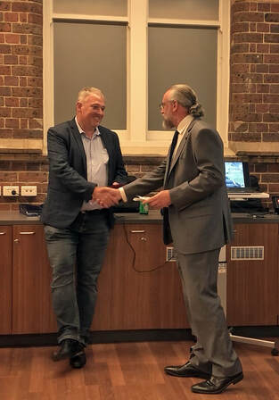 Professor Peter Betts being named the Geological Society of Australia’s W.R Browne Award winner for 2021 Professor Peter Betts being named the Geological Society of Australia’s W.R Browne Award winner for 2021
The W.R. Browne Award is for distinguished contributions to the geological sciences in Australia. The GSA National Awards Committee noted Professor Betts’ contributions to research, teaching, and to the GSA.
The Society described him as ‘influential in the development of models pertaining to the assembly of the Australian continent through time’. “In addition, we would like to recognise that you have made a significant contribution to teaching over many years including as a mentor and role model to geoscientists,” the GSA said. |
2020
PAST EVENTS
|
Dec 17, 2020
12:30pm |

Lunchtime Lecture
The development of shear planes in ductile shear zones: a numerical modelling approach Dr Melanie Finch Assistant Lecturer School of Earth, Atmosphere and Environment (Monash University) Online presentation via Zoom. Please check TVG newsletter for link/Meeting ID. Bio Dr Melanie Finch is a structural and metamorphic geologist at the School of Earth, Atmosphere and Environment at Monash University. She completed her PhD in 2016 on the evolution of a thick, high strain shear zone. She was then awarded the Alexander von Humboldt Foundation Postdoctoral Fellowship, based at the University of Tuebingen in Germany, where she modelled the development of ductile shear zones. Her current focus is on subduction shear zones and the relationship between high pressure fluids and deformation. Melanie is a 2021-2022 ‘Superstar of STEM’ and runs the WOMEESA seminar series, which features monthly seminars from women Earth and Environmental Scientists. Dr Melanie Finch's research output |
|
Sept 30, 2020
12:00pm |
Lunchtime Presentation
Australia’s longest coastal cliffs: size, reasons, rarity Dr Gresley Wakelin-King Wakelin Associates Dept. Ecology, Environment and Evolution, La Trobe University Bio I’m a process geomorphologist specialising in drylands rivers and broadscale studies in the Australian rangelands. After studying geology at the University of Queensland, I went regional mapping with the NT Geological Survey in lovely Alice Springs. During my doctoral work (ephemeral rivers in western NSW, from La Trobe university) I became interested in the application of geomorphology to sustainable land management. I realised recently that I’ve been working in the arid lands since Hawkie was Prime Minister. |
|
Aug 27, 2020
6.00pm |
Annual General Meeting (AGM)
Online only due to Covid-19 😷 Members will be notified via email on how to join the meeting using ZOOM. |
|
June 25, 2020
7.00-8.15pm |
The 2020 Howitt Lecture
A joint presentation with the Royal Society of Victoria Alfons H. M. VandenBerg WRITING ON STONE: GRAPTOLITES AND ANCIENT GROUND In light of COVID-19 restrictions, this year’s Howitt Lecture will be conducted online, with the presentation professionally filmed and our speaker joining discussion via Zoom conference (invitations to register are sent via email from each organisation to its members). The presentation and Zoom conference will be livestreamed via The Royal Society’s Facebook site. |
2019
PAST EVENTS
|
October 31, 2019
6.00pm |
Monthly GSAV meeting - STUDENT NIGHT (with free Pizza)
Talks will be preceded by drinks from 5.30pm (tearoom, 4th floor). Talk starts at 6.15pm. Location: Fritz Lowe Theatre, School of Earth Sciences, University of Melbourne 
Matt Wood
Arc segmentation and landscape evolution in the Bhutan Himalaya Abstract Often characterised as a seismic gap, the physiographically distinct eastern Himalaya has certainly revealed a paucity of large earthquakes throughout the instrumental record, yet likely experiences shortening equivalent to that of the wider arc. As orogen-normal structural geometries have become increasingly well constrained, attention has shifted to how the range is segmented along its length; an effort which took on a renewed urgency following the 2015 Gorkha earthquake in Nepal. This project integrates quantitative geomorphometry, millennial-scale erosion rates and exhumation signals at geological timescales from modern surface samples and synorogenic sedimentary archives. The results point to differential landscape evolution across Eastern Bhutan driven by persistent along-strike heterogeneities in the local tectonic architecture, and define an important second-order segment boundary of the Himalayan arc. Bio Matthew Wood gained his BSc and MSc in geology at Victoria University of Wellington between 2001 and 2006. During the following decade, Matt’s work alternated between minerals exploration projects in the tropics and science media. Field experiences from Antarctica to the Amazon drove a passion for photography and videography. As an independent content creator Matt has produced podcasts and web videos for educational and advocacy groups as well as geological 3D animations and VR models. During his PhD candidature at the University of Melbourne he has enjoyed three wonderful field seasons in the Himalaya and is very grateful to the GSAV for supporting conference attendances in Switzerland and Germany in late 2018. 
Chris Voisey
The first analysis of a telescoped orogenic system: Insights from the Fosterville gold deposit Abstract The Fosterville Au deposit is hosted in the Bendigo Zone within the western Lachlan Orogen, south east Australia, and contains three distinct mineralisation styles: (i) refractory Au in fine-grained arsenopyrite and arsenian pyrite disseminated throughout metasedimentary rocks near brittle faults; (ii) visible Au hosted in fault-controlled quartz-carbonate veins associated with stibnite mineralisation; and (iii) vein-hosted native Au with little or no associated stibnite. Refractory Au mineralisation is found throughout the deposit, whereas visible Au ± stibnite occurs deeper in the system (>800 m depth from surface). Thus, Fosterville provides a unique opportunity to study a telescoped orogenic Au system that changes mineralisation style as a function of depth. Microscopy, neutron tomography, nanoscale secondary ion mass spectrometry and field observations have been conducted to investigate mineralogical and structural controls on the various styles of Au mineralisation. These observations are used as the foundation for equilibrium geochemical modelling using HCh software. Results are considered in the context of an evolving mineral system over the history of the deposit and relative timing of mineralisation is inferred. Two alternatives for the genesis of such a system include: (1) metal deposition was controlled by ongoing physiochemical changes at a very shallow level in the crust in one evolving mineralisation stage, or (2) two or three deposits formed in the same location, with each different style of mineralisation representing a separate period of fluid infiltration, each potentially tens of millions of years apart. Based on our results, we suggest that the latter is more likely. Therefore, we suggest that Fosterville is the first example to be recognized of a telescoped orogenic Au system, where relatively high-temperature mineralisation and alteration assemblages were overprinted vertically by later, lower temperature assemblages. Bio Chris Voisey is a PhD researcher at Monash University, Australia, focusing on orogenic gold systems in central Victoria. He moved to Australia in 2016 from Newfoundland, Canada, where he completed a B.Sc. (Hons.) degree at Memorial University. He spent three years working as a field assistant for the Geological Survey of Newfoundland and Labrador. Following this, he conducted exploration on self-owned and contracted properties. Chris’s research now focuses on integrating geochemistry with structural geology to better understand ore genesis and develop applications toward mineral exploration. 
Campbell van Praagh
The White Hills Gravel and Calivil Formation throughout west central Victoria: stratigraphy and landscape analysis Abstract The White Hills Gravel (WHG) and Calivil Formation (CF) are extensive Cenozoic fluvial gravels deposited under predominantly high energy flow conditions within ancestral braided streams across much of central and western Victoria. Detailed landscape analysis, including long- and cross-sections through deposits and comparisons to nearby modern streams, reveals that there are generally two levels of these gravels; the older, higher level gravels are best identified as WHG and the younger, lower level gravels, which often continue downstream beneath basalt or sediment cover as deep leads, as CF. Even the oldest gravels follow similar courses to the modern drainage, and the occurrence of both elevated outcrops and deep lead gravels buried beneath younger valley alluvium indicates periods of regional incision and aggradation throughout the Cenozoic. Deposition of the gravels of both formations was primarily due to episodic high energy flood events, as shown by thicker beds of coarse sediment with very poor sorting, large maximum clast size (sometimes >1 m) and common freshly-eroded, first-cycle bedrock clasts. Bio Campbell is a second year Ph.D. student at the Department of Ecology, Environment and Evolution at La Trobe University investigating the geology and geomorphology of the White Hills Gravel and Calivil Formation across central Victoria. His research involves re-mapping and ground-truthing previously mapped deposits while using the outcrops to interpret aspects of the Cenozoic landscape and climate of Victoria. He is particularly interested in better understanding the depositional environment of the gravels. 
Hayden Dalton
The Geochemistry and Geochronology of Finnish Kimberlites Abstract Kimberlites are small-volume, volcanic rocks that derive from deep within the Earth (> ~150 km). They have attracted considerable economic and scientific interest because; 1) they are the primary host rocks to diamonds; 2) as the deepest derived magmas, they reveal insights into the origin of deep-seated, low-volume melts and 3) they provide a window through which we can examine the evolution of the Earth’s mantle. Although kimberlite magmas have been emplaced on every continent over the last 2.8 billion years, there remains debate concerning the sources of kimberlites and what triggers mantle melting to form these enigmatic rocks. The majority of scientific research has focussed on the highly diamondiferous kimberlites of Southern Africa, Siberia and most recently, Canada. However, much can be learned from examining other regions with different geological histories to piece together the petrogenesis of kimberlites. The present study investigate kimberlites from the Baltic Shield, a Shield with a diverse but well-constrained geodynamic history, utilising geochronology and radiogenic isotopes to ascertain the evolution and triggers of kimberlite magmatism in this region of the Earth. |
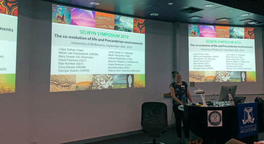
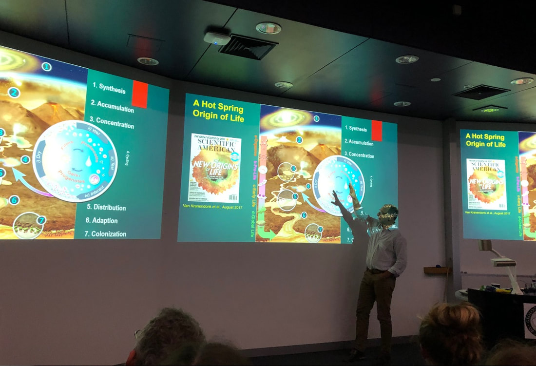
|
August 29, 2019
6.00pm |
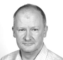
Monthly GSAV meeting
Talk by Assoc Professor Gavin Mudd (RMIT) Critical Metals and the Circular Economy: Key Issues and Opportunities Talk will be preceded by drinks from 5.30pm (tearoom, 4th floor). Talk starts at 6.15pm. Location: Fritz Lowe Theatre, School of Earth Sciences, University of Melbourne Abstract
There is considerable focus on the circular economy in academic, industry and government sectors, although very little of this attention truly understands the place of mining in a circular economy. The circular economy, in theory, aims to maximise resource efficiency and minimise environmental impacts. In reality, mining is responding to the continually growing demands of modern society for raw materials and energy to meet technological, infrastructure and other needs (e.g. military) – with most metals largely still in use or disposed of and only moderate recycling is undertaken. The extent of consumption is often closely linked with economic activity (e.g. consumption per capita), and the patterns of consumption differ between metals. Although recycling is a noble objective for various reasons, it can never be perfectly efficient, and there are still large populations around many parts of the world which aspire to modern standards of living – meaning that mining will still have a role to play in supplying raw materials and energy for decades to come. The real questions come simply to what we mine, where, how and ensuring all costs are taken into account (e.g. to avoiding externalities such as accidents or long-term pollution risks). Increasingly, many metals are being viewed as so crucial to modern technology, such as indium and LCD screens or neodymium and permanent magnets, that they are labelled as ‘critical’ – any disruption to supply could have serious implications for society. These critical metals include indium, rare earth elements, tellurium, gallium, cobalt, platinum group elements, lithium and many others – although most of these are typically by-products and not the primary target of mining. This leads to the situation whereby critical metals are mostly dependent on their primary metal cousins for their supply – but very little is known about the flows of critical metals from mineral resources through ore processing, smelting and/or refining and their subsequent use in products. In many cases, significant financial value could be realised from a greater focus on critical metals. For example, PGEs are now reported from Glencore’s Sudbury operations or the giant Olympic Dam project in Australia also contains rare earths which are equal to the combined Cu-U-Au-Ag value currently extracted. In the public policy sphere, poor information on many of the critical metals is often (and all too easily) confused with a lack of mineral resources (or reserves) and an inability to meet future consumption or demand patterns – but nothing could be further from the truth. In reality, markets for critical metals have historically been small and niche only – but with the growth in consumer electronics and renewable energy (especially solar photovoltaic panels and the rapid rise occurring in battery storage systems), this means critical metals will play a greater role in meeting future societal needs. Based on detailed resource case studies from primary metals, combined with specific case studies of indium, rare earths, lithium and cobalt, this presentation will justify the case for optimism that mining will continue to play a key role in providing the raw materials needed for a circular economy. Bio Assoc. Prof. Gavin Mudd has been at the forefront of research on the sustainability of modern mining for over 20 years, with detailed research across almost sectors of the industry. To date, he has published over 200 scientific and technical papers and reports, about two-thirds of which are peer-reviewed. In recent years, Gavin has published world-leading papers on the global mineral resources of copper, uranium, lead-zinc, nickel, platinum group elements, rare earth elements, indium, and together with PhD students has helped pioneer approaches to quantifying critical minerals despite the lack of directly reported data. He has worked closely with local and indigenous communities across Australia, Papua New Guinea, parts of Africa and elsewhere – helping to navigate and support understanding of the environmental risks and management of mining (e.g. water, tailings, rehabilitation, energy-carbon issues, etc). Gavin’s reputation has seen him contribute to projects for the International Resources Panel, UN Environment’s Global Environmental Outlook-6th Edition, Geoscience Australia, Columbia University, Yale University and a range of other international research and consulting projects. Overall, Gavin is a unique and world-leading expert voice on mining and sustainable development and perfectly placed to communicate the challenges and opportunities for Australia and a circular economy. |
|
July 25, 2019
6.00pm |
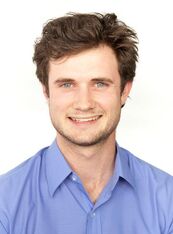
Monthly GSAV meeting
Talk by Micheal Webster (Golder Associates) Geology of Melbourne Talk will be preceded by drinks from 5.30pm (tearoom, 4th floor). Talk starts at 6.15pm. Location: Fritz Lowe Theatre, School of Earth Sciences, University of Melbourne Abstract
With several large scale infrastructure projects underway across Melbourne, there is a great opportunity to improve on the current understanding of the geological evolution of our city. Michael will provide an overview into the various geological units that are found in an around Melbourne, highlighting their different geological histories and properties. He will also discuss the advances in three dimensional geological modelling, and its impact on project delivery. About the presenter Michael has been an engineering geologist with Golder Associates for eight years. He has undergraduate degrees from Monash University in engineering and science, majoring in geotechnics and geology respectively. He also holds a masters degree from Imperial College London in engineering geology. Outside of work he enjoys reading, gardening and cooking. |
|
June 27, 2019
6.00pm |
Howitt Lecture 2019
A joint presentation between the Royal Society of Victoria (RSV) and the Geological Society of Australia Victoria Division (GSAV). Talk by Stephen Gallagher (The University of Melbourne) From Monsoons to Desert: 50 Million Years of Australian Climate History Location: The Royal Society of Victoria, 8 La Trobe Street, Melbourne, VIC 3000 Time: Food & drinks from 6:00pm, lecture from 7:00 pm – 8:30 pm AEST Description
The 2019 Howitt Lecture - a joint presentation between the Royal Society of Victoria and the Geological Society of Australia (Victoria Division) Geoscience in Australia can be uniquely challenging. The harsh, arid and intense monsoonal climate of our continent generally destroys much evidence of its past activity over millions of years on land. Offshore, however, the story is different. The ocean floor receives and preserves huge quantities of dust and sediment derived from river outflow, recording dry and wetter conditions over millions of years, rather like many tree species' rings record the seasons. The International Ocean Discovery Program (IODP) is the largest geoscience research program in the world. Over the last 50 years this program has used a variety of floating platforms and ships to drill cores from the sea bed beneath them in order to investigate Earth’s history, leading to extraordinary discoveries about our paleoclimate and plate tectonics. In the last 5 years, the IODP vessel RV Joides Resolution carried out several expeditions in Australasian waters. This talk will focus on a two-month expedition off northwest Australia led by Associate Professor Stephen Gallagher. This expedition cored over 6 kilometres of sediment beneath the sea bed to obtain a 50 million years record of Australian geological history, an archive that reveals a story of the waxing and waning of the Australian monsoon, Indonesian Throughflow and onset of continental aridity. About the Speaker Associate Professor Stephen Gallagher is a reader at the School of Earth Sciences the University of Melbourne. His research focusses the use of (micro)fossils and sediments to interpret ancient marine environments and to establish their age. In the last few years he has been on two International Ocean Discovery Program expeditions. He was an invited scientist on an expedition to the Japan Sea in 2013 and co-chief scientist on another expedition in 2015 off Northwest Australia. He has published over 100 publications including 80 journal papers, 12 book chapters and dozens of major reports. He was chair of the Geological Society of Australia Victoria division from 2006 to 2008. |
|
May 02, 2019
6.15pm |
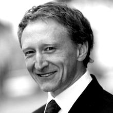
Annual General Meeting
Talk by Graeme Beardsmore Lead Researcher at Melbourne Energy Institute and Technical Director at Hot Dry Rocks Heat Flow: The neglected potential field for mineral exploration Talk will be preceded by drinks from 5.30pm (tearoom, 4th floor). Talk starts at 6.15pm. Location: Hills Lab, McCoy 220, School of Earth Sciences, University of Melbourne Abstract Conductive heat flow is a valid ‘potential field method’ for mineral exploration. The physics of steady state conductive heat flow is mathematically the same as gravitational acceleration, with buried heat sources analogous to buried masses. Some ore deposits, most notably iron-oxide-copper-gold-uranium (IOCG-U) deposits like Olympic Dam, are also significant sources of heat. Detecting a buried heat source can therefore provide direct evidence of an economic ore body. The physics is robust, and appropriate tools exist for the collection of heat flow data for exploration. It is therefore intriguing that heat flow is not used as a routine mineral exploration tool. This talk explores the likely reasons for this, and suggests some simple strategies that can yield valuable information about the thermal state of the subsurface, and hence mineral prospectivity, for a small marginal cost above normal exploration expenses. Speaker bio Graeme has leveraged his technical background in heat flow and temperature measurement and modelling into a much broader involvement in the global geothermal energy sector. His current focus is on pre-drill risk mitigation for geothermal energy, an area that he believes is key to making geothermal power generation more attractive to investors and would-be developers. He has experience in the following: - laboratory thermal property measurements for constraining models of underground temperature - developing global standards for defining, estimating and reporting geothermal resources/reserves - R&D into quantifying exploration uncertainties for financial modelling - R&D into new exploration technologies - R&D into new power generation technologies - collaborating with the World Bank, UNECE, IEA-GIA, IRENA and other global bodies - education and information dissemination Increasingly, his work in geothermal is finding relevance and application in other resources fields such as petroleum exploration, mine ventilation design, base metals exploration, and groundwater. |
|
Mar 28, 2019
6.15pm |
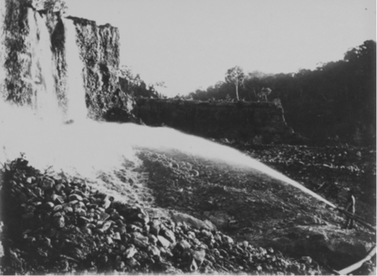 Hydraulic sluicing in Victoria Hydraulic sluicing in Victoria
Monthly GSAV meeting
Talk by Prof Susan Lawrence (Latrobe University) & Dr James Grove (University of Melbourne) Holes, heaps and homogenisation: how historic gold mining in Victoria changed geomorphological and legal landscapes. Talk will be preceded by drinks from 5.30pm (tearoom, 4th floor). Talk starts at 6.15pm. Location: McCoy-220 (Hills Lab), School of Earth Sciences, University of Melbourne NOTE: Not the usual location! Abstract Although we are taught about the gold rushes in Victoria in many ways the landscape changes have been forgotten. Massive volumes of sediment were processed for gold in, and next to, river systems from the 1850’s onwards. We will present our research reconstructing the volumes of sediment worked, where they were redistributed in the landscape, and how this forged a path for environmental legislation. Rivers of Gold Project Website: https://rivers-of-gold.com/ Bio Professor Susan Lawrence Susan's research area is the physical evidence of the recent human past. Her current research is about the environmental history of water use in the nineteenth-century mining industry and the resultant pollution of rivers. This work has also addressed the archaeology of British colonisation, gender, urban development, and material culture studies. She is a past president of the Australasian Society for Historical Archaeology and convenes the Victorian Archaeology Colloquium. She is also a member of the Heritage Council of Victoria's Archaeology Underwater Cultural Heritage Committee, a Fellow of the Australian Academy of the Humanities and a Fellow of the Society of Antiquaries of London. Bio Dr James Grove James is a geomorphologist who uses GIS and field research to undertake research on riverbank erosion, arctic fluvial geomorphology, and river condition assessment. |
|
Feb 28, 2019
6.15pm |
 Image source: Google Earth Image source: Google Earth
First Monthly GSAV meeting in 2019
Talk by Dr Vince Morand (La Trobe University) Landslides in Kyrgyzstan Talk will be preceded by drinks from 5.30pm (tearoom, 4th floor). Talk starts at 6.15pm. Location: Fritz Lowe Theatre, School of Earth Sciences, University of Melbourne Abstract Kyrgyzstan lies in a mountainous part of central Asia. In large parts of the nation mass movement (landslides, earth flows, rock falls and slumps) is the dominant process in the formation of its landscape. Deaths due to landslides are common, with at least 24 people killed in 2017. High quality Google Earth images show landslide scars and deposits clearly, ranging from recent ones (in the last year or two) to older ones that are vegetated and rounded off by erosion. Within Kyrgyzstan, landslides occur in two distinct areas, each with distinct types. The first area is the mountainous terrain of the Tien Shan and Alay Ranges. The most common landslide type here is rock fall, typically forming a pile of debris at the base of a steep slope with an obvious scar. Some of these have dammed valleys, creating lakes. These can be dangerous if the dam fails at some stage and results in flash flooding downstream. Also, some rock falls turn into mobile debris flows that travel kilometres down valleys. Most of these landslides are small but there are a few large old deposits (>15 square km). Because the mountainous area is thinly populated, landslides do not impact much on people and property here. The second area is a zone of foothills ringing the Fergana Basin. This area has a high density of landslides, including slow moving slumps and catastrophic mudflows and debris flows. Most of these seem to be developed in loess (wind-blown silt and clay) that blankets much of this area. Many landslides here happen after heavy rain in the months of April and May. They typically initiate on moderate to low slopes, demonstrating that the combination of weak rock or regolith with high rainfall is more important than steep slopes in causing landslides here. Because these foothills are populated with small villages and farms, with large towns in the adjacent alluvial flats, a large population is at risk from landslides. Even the slow-moving slumps and slides can destroy buildings, roads and power lines, cutting off access to rural areas. It appears that clearing of forests has contributed to the landslide risk in the foothills area, so revegetation programs can help alleviate the risk. However, such a large area is unstable that there are few options for avoiding landslides, other than close monitoring of hazardous areas to give warnings of impending slides, saving lives if not property. |
2018
|
Nov 29, 2018
6.15pm |
Monthly GSAV meeting
Talk by Neville Rosengren (Latrobe University) Small is important. How can we retain (and maintain) local geoscience sites? Talk will be preceded by drinks from 5.30pm (tearoom, 4th floor). Talk starts at 6.15pm. Location: Fritz Lowe Theatre, School of Earth Sciences, University of Melbourne Abstract Despite the obvious and essential role of (indoor) laboratories in geological research and teaching, the motivation to study earth science for many students is—apart from spectacularly inspiring lecturers in first semester of first year—the drive to understand the nature and origins of landscape and landscape materials. To this end, it is essential that areas of land displaying geological and/or geomorphological features important for teaching and research (geoscience sites) are available for bona fide access. Recognition and appraisal of the attributes of geoscience sites has been achieved across much of Victoria since the 1970’s by a range of focused and coincident studies. It is one thing to know what and where these sites are: it is altogether another item to have any (let alone) on-going access to them and be reasonably assured that they will be there this time next year or next decade. The various barriers to the longevity of geoscience sites include—apart from ambient processes—freehold ownership and the absence in Victoria of a legislative framework to give recognition and protection. Neville’s presentation will range visually across geoscience sites of varied scales and nature in Victoria and discuss issues in the conservation and management of such. Comparisons will be made with other jurisdictions and protocols in Australia and elsewhere. Bio Neville Rosengren is one of a rare and endangered species—a geoscientist attached tenuously to La Trobe University. His career of 50+years (and continuing) has included the rare position (for Victoria) of teaching Matriculation Geology, and spans extended episodes of further teaching and research at Melbourne University Department of Geography, RMIT Department of Landscape Architecture and as a Surgical Geologist (true) at La Trobe University for 20 years, where he is now an Honorary Associate. For understandable reasons he now is a resident of New Zealand, but is half the time on various consultancy projects in Australia. |
|
Oct 25, 2018
6.15pm |
 Dr Sandra McLaren Dr Sandra McLaren
Monthly GSAV meeting
Talk by Dr Sandra McLaren (University of Melbourne) Hot rocks in a cold place: possible clues to ice sheet dynamics from the continental rocks in southern and central Australia Talk will be preceded by drinks from 5.30pm (tearoom, 4th floor). Talk starts at 6.15pm. Location: Fritz Lowe Theatre, School of Earth Sciences, University of Melbourne Abstract Important geological linkages connect Australia and Antarctica. Prior to the breakup of Gondwana (beginning around the late Cretaceous) cratonic rocks of southern Australia, including the Gawler and Curnamona cratons, are thought to have been contiguous with similar aged rocks in East Antarctica. In Australia, excellent outcrop exposure means that these rocks are reasonably well understood. One of the key characteristics of these Australian Proterozoic-aged cratonic blocks is unusually high measured surface heat flow, averaging 2-3 times that of similarly-aged cratonic blocks elsewhere globally. This high heat flow arises from anomalously high concentrations of the heat producing elements, U, Th and K, which have been demonstrated to profoundly impact a range of temperature-dependent geological processes, such as metamorphism and magmatism. Geochemical analysis of rocks from the George V Land-Terre Adelie and eastern Prydz Bay regions suggest heat flow is highly heterogenous in East Antarctica, with the presence and variable distribution of U, Th and K enriched crustal rocks providing a first-order control on sub-glacial heat flow variations. Known variations in abundance and distribution of heat producing elements within the Antarctic continental crust results in greater and much more variable regional sub-glacial heat flows than currently assumed in ice modelling studies. Such elevated heat flows may have significant effect on ice sheet behavior and highlight the importance of assessing the geological controls on heat flow for predictions of ice mass balance and sea-level change. Bio I am a geologist with research interests in a wide range of earth science fields. I completed my PhD at the University of Adelaide in 2001 and subsequently held a postdoctoral appointment at the University of Melbourne and an ARC Postdoctoral Fellowship (APD) at the Research School of Earth Sciences at the Australian National University, and recently completed an ARC Australian Research Fellowship at the University of Melbourne (2009-2017). I am currently employed as a Senior Lecturer in Structural Geology and Tectonics in the School of Earth Sciences. My main research interest is in understanding the long term evolution of the Australian continent and I have a research track record in a range of geological fields, including Proterozoic tectonics, the origins and thermal impacts of high heat producing granites in Australia, crustal and lithospheric thermal structure, the Neogene evolution of the Murray Basin (including the onset of arid climatic conditions), argon thermochronology methods and applications, and the structural and tectonic evolution of the Papua New Guinea highlands. |
|
Sept 27, 2018
6.15pm |
 Dr Alan D Partridge Dr Alan D Partridge
Monthly GSAV meeting & Selwyn Lecture
Talk by Dr Alan D Partridge The Elephant in the Gippsland Basin Talk will be preceded by drinks from 5.30pm (tearoom, 4th floor). Talk starts at 6.15pm. Location: Fritz Lowe Theatre, School of Earth Sciences, University of Melbourne Abstract The Gippsland Basin is a world-class hydrocarbon and brown coal province. The basin contains one giant or jumbo oil field that ranks just within the 100 largest oil fields in the world and another that ranks just outside the top one hundred. By this benchmark it represents Australia's only oil Super Basin discovered to date. Unfortunately, any study of the plethora of publications and unpublished open file reports will not reveal any coherent story as to why the basin is so prolific. As is generally the case with geology it is not possible to point to just one explanation, but rather the reason lies in a multiplicity of circumstances in the geological history of the Gippsland Basin that have combined to make the basin exceptional. Using several of the common elephant metaphors as a linking thread, the talk will recount a half century personal journey towards understanding the geological evolution of the Gippsland Basin and the elements and processes of the petroleum systems behind the discovered hydrocarbon resources. The elephant metaphors are used as links between what we don't acknowledge or understand, what we can't resolve or can only poorly comprehend, and what we speculate about, or hope actually occurs, in an attempt to provide a convincing story about the most important events in the basin. The aim is to make the complexities accessible to both those of the audience who are knowledgeable about the basin, and those who only have a fleeting acquaintance with its geology. Most of the giant oil and gas fields discovered in the halcyon early years of offshore exploration in the Gippsland Basin are now either nearly depleted or are in severe production decline. With little or no large discoveries over the last quarter century the basin is considered to be well past its prime maturity and the remaining prospectivity, or chance of future large oil discoveries, is considered to be low. Hopefully, some of the ideas presented in this talk will change those perceptions so that in this modern world of alternative facts and theories they will make the Gippsland Basin great again! Bio Alan D. Partridge received a BSc Honours degree from the University of Sydney (1968), a MSc from the University of NSW (1972) and a PhD from La Trobe University (2000), and is a member of AAPG, AASP, AIG, BMS, GSA, PESA and the Royal Societies of N.S.W. and Victoria. He spent 21 years with Esso Australia Ltd, working principally as a palynologist on most basins throughout Australia, but with a special and continual focus on the Gippsland Basin. Since 1992 he has worked as a consultant palynologist, biostratigrapher and geologist for Biostrata Pty Ltd, and briefly held an honorary Research Fellowship with La Trobe University. His initial interest in palaeontology and biostratigraphy was sparked by the ability of those specialities to provide a chronology to the geology and thereby tell a better story. This lead to a lifelong career as a palynologist, starting when the discipline was still undeveloped and in need to both extensive systematic taxonomy and the establishment of standardised zonations. His contribution to these fields is highlighted by his joint-authorship of the Late Cretaceous to Cenozoic spore-pollen zonation of the Gippsland Basin with Dr Lew Stover, and the framework spore-pollen and microplankton zonations for the Australian Mesozoic with co-authors Dr Robin Helby and Dr Roger Morgan. Although these endeavours remain important and are ongoing, the true strength and continuing appeal of palynology is its application as one of the pre-eminent tools, along with seismic and sequence stratigraphy, for understanding the geological history of all Mesozoic and Cenozoic stratigraphic successions in Australia. Unlike other continents the outcrops of these younger stratigraphic ages are poor, with the most complete successions being found in the subsurface, especially under the continental shelves. Furthermore, ammonites the traditional fossils used for finely subdividing the Mesozoic stages in Europe are rare in Australia and seldom encountered in wells and bores, while calcareous microfossils such as planktonic foraminifera and nannofossil have limited application because carbonate successions are geographically restricted or patchy throughout all but the youngest parts of the Mesozoic and Cenozoic. Palynology has proved to be the most widely used biostratigraphic tool to replace these and all other fossil groups. But beyond just the appeal of the palynomorphs as fossils worthy of study, and the application of biostratigraphy to telling the chronological story of the sediments, palynology can also provide insights into the origin, distribution and maturation of hydrocarbon source rocks and the development of new exploration concepts in the ongoing search for new hydrocarbon fields, as he will attempt to show in his talk about the elephants that are to be found In the Gippsland Basin. |
|
Aug 30, 2018
6.15pm |
 Dr John Moreau Dr John Moreau
Monthly GSAV meeting
Talk by Dr John Moreau (University of Melbourne) A newer and simpler approach to microbial bioremediation of wastewater from gold ore processing Talk will be preceded by drinks from 5.30pm (tearoom, 4th floor). Talk starts at 6.15pm. Location: Fritz Lowe Theatre, School of Earth Sciences, University of Melbourne Bio
Dr. Moreau is a geomicrobiologist who studies microbial community responses to industrial contaminants in both anthropogenic and natural environments. He is particularly interested in microbial interactions and how they may affect the chemical transformations of pollutants, as well as the evolution of microbial resistance to extreme environmental conditions. He obtained his Ph.D from the University of California-Berkeley in 2006, and served as a U.S. Geological Survey postdoctoral fellow before joining The University of Melbourne in 2008, where he is currently a Sr. Lecturer in the School of Earth Sciences. |
|
July 26, 2018
6.15pm |
STUDENT NIGHT
Talks will be preceded by drinks from 5.30pm (tearoom, 4th floor). Talks starts at 6.15pm. Location: Fritz Lowe Theatre, School of Earth Sciences, University of Melbourne Come and see the next generation of Earth Scientists:
Anindita Samsu
Title Do fractures have ancestors? Linking fractures with pre-existing structures in a rift basin Abstract Fractures in the rocks that fill sedimentary basins are usually perpendicular to the direction of the regional basin-forming stretching or rifting. However, many rift basins contain fractures that are oblique to their expected orientation. Previous work has suggested that this discrepancy results from interactions between the regional extension and pre-existing structures in the underlying basement rocks. This study explores such interaction between basement rocks and the overlying sedimentary rocks of the onshore Gippsland Basin in southeastern Australia by integrating geological field data, geophysical data, high-resolution UAV imagery, and analogue modelling. Bio Anindita Samsu is a third year PhD student in geology in the School of Earth, Atmosphere and Environment at Monash University. Her research focuses on exploring structural inheritance in rift basins using multi-scale fracture data. She is interested in how brittle deformation (a.k.a. fracturing) is influenced by pre-existing structures, which has implications for the transport and distribution of natural resources in the crust. Sina Khatami
Title Evaluating conceptual (hydrologic) models: overview and the new approach of Flux Mapping Abstract All models are wrong, all data are erroneous, our knowledge of real-world processes is fallible, and all model evaluations are incomplete. Despite the limitations, there is room to improve models and evaluation schemes. In this talk, I first present an overview of the different aspects of model evaluation. Then, I introduce a novel evaluation approach (called Flux Mapping), and demonstrate its diagnostic power in characteristing model behaviour over conventional methods. Although the concepts are mainly discussed within the context of hydrologic modelling, they are extendable to any field of scientific modelling dealing with open complex systems in the face of uncertainties. Bio Sina received his BSc in Civil Engineering at Ferdowsi University of Mashhad, Iran, and his MSc (summa cum laude) in Water Resources from Lund University, Sweden. His MSc thesis, “nonlinear chaotic and trend analyses of water level at Urmia Lake, Iran”, was awarded Sweden’s Best Master Thesis of the Year (2013) in Environmental Sciences. Since April 2014, he is a PhD Candidate at the Department of Infrastructure Engineering, University of Melbourne, researching on “improving conceptual hydrologic modelling: connecting the dots between complexity, uncertainty and equifinality”. In 2016, Sina was named “Postgraduate International Student of the Year–Research” by the Council of International Students Australia (CISA). Apoorv Jyoti
Title Dissolution patterns and rates in a heterogeneous limestone studied by using a multi-component reactive transport model at the pore scale Abstract Reactive transport modelling at the pore scale explores the spatial-temporal changes in the pore network geometry, the flow field and water composition at sub-centimetre scale. It requires a true representation of fluid-mineral boundaries and their role as zones of fluid-mineral reactions, spatially explicit mass transport and a set of chemical equations to calculate the aqueous speciation and rate of reactions. Flow-through experiments were carried out to study the dissolution of a small bioclastic limestone core from Mt. Gambier, South Australia, through the injection of an acid. The time-dependant pore network geometry of the sample was derived from micro-CT images and the water composition continuously monitored throughout the experiment. A comparison was done for the whole-core dissolution rate derived from the image-based change in volume fraction, the quantification of dissolved calcium in the outflow and the 3D reactive transport model. This study highlights the need to include the aqueous chemical system in reactive transport modelling to predict the dynamic changes in dissolution rates and the associated changes in the pore geometry. Bio Apoorv is currently his PhD at the Peter Cook centre for CCS research at the University of Melbourne. He is a hydrogeologist by training and currently works on numerical modelling of fluid flow coupled with the geo-chemistry at the pore scale. |
|
June 28, 2018
7.00pm |
 Professor David Cantrill Professor David Cantrill
HOWITT LECTURE 2018
A joint lecture with the Royal Society of Victoria Talk by Prof DAVID CANTRILL The Great South Land: connecting the floras of the Southern hemisphere through the Antarctic fossil record Location: The Royal Society of Victoria, 8 La Trobe Street, Melbourne Time: 7.00pm - 8.15pm (AEST) Note: You'll have to register for the event (no fee for GSAV members). |
|
May 31, 2018
6.15pm |
 Prof Trevor Ireland Prof Trevor Ireland
Monthly GSAV meeting @ Melbourne University
Talk will be preceded by drinks from 5.30pm (tearoom, 4th floor). Talk starts at 6.15pm. Location: Fritz Lowe Theatre, School of Earth Sciences, University of Melbourne Prof Trevor Ireland (ANU) Field trips to the asteroids Abstract
Two sample return missions are headed to their asteroid targets this year. The Japanese Aerospace Exploration Agency (JAXA) Hayabusa2 spacecraft is rapidly approaching its target asteroid Ryugu, going in to orbit in early June. NASA’s Osiris-REx mission will approach asteroid Bennu in December this year. These missions will sample these C-type asteroids. The asteroids are expected to be Carbonaceous and potentially analogous to carbonaceous chondrites that are available in our meteorite collections. These meteorites contain abundant organic compounds and potentially brought those materials in to Earth as the seeds of life, and are also water rich. Understanding the nature of the C-type asteroids is thus very important for understanding volatiles on Earth. However, much of the processes involved in asteroid evolution are lost in the meteor re-entry to Earth. JAXA is building on the success of its Hayabusa mission to the S-type asteroid Itokawa. The name S-type alludes to the stony mineral contributions that are apparent in the infrared spectra. Hayabusa returned its sample capsule to Woomera in 2010 and analysis of the dust grains contained in it places the Itokawa asteroid as a parent body of the LL chondrite stony meteorite class. Will Earth-crossing asteroids such as these pose risks to the inhabitants of Earth? Well they certainly have in the past. A key element in mitigating this risk is to understand what these asteroids are made of, as well as their internal structure. The best way of getting our hands on this sort of data is going there, and bringing samples back. |
|
April 26, 2018
6.15pm |
Monthly GSAV meeting @ Melbourne University
Talk will be preceded by drinks from 5.30pm (tearoom, 4th floor). Talk starts at 6.15pm. Location: Fritz Lowe Theatre, School of Earth Sciences, University of Melbourne Dr. Gresley Wakelin-King (Wakelin Associates) Landscapes of the Diamantina: greenfields geomorphology investigations supporting sustainable land use  Circular swamp in the gibber uplands of Sturts Stony Desert. Google Earth image; white scale bar = 5 km Circular swamp in the gibber uplands of Sturts Stony Desert. Google Earth image; white scale bar = 5 km
Abstract
The Lake Eyre Basin’s rivers and landscapes have a high profile in Australian national identity, but access is difficult and the area is under-researched. This talk presents results from one of the baseline geomorphology studies conducted for the SA government. The client’s priority was information in support of sustainable land management, but along the way there was plenty of scope for curiosity-driven geology, with applications in sedimentological analogues, basin architecture, biophysical systems, tectonics, and regolith. The Diamantina River flows along neotectonic valleys in anabranching channel systems set in mud-aggregate floodplains. The river’s flow path was diverted by the creation of the Simpson Desert dunefield. Its present course, between dunefield and gibber uplands, includes interesting and largely undocumented fluvial landforms. Terrestrial ecosystems battle the world’s most variable flow regime, with the (occasionally treacherous) help of a shallow aquifer. The gibber uplands have a surprising variety of silcrete expression, with indications of currently-undocumented groundwater-dependant ecosystems, and the possibility of Eromanga Basin structures and formation fluids influencing Cainozoic duricrust development. About the speaker
Gresley has been working in the Australian drylands for over 30 years, beginning with an honours project on the shoreline of Lake Buchanan, Queensland. In her early years with the Northern Territory Geological Survey she worked in rocks, regolith, and structural geology, using targeted field investigations to resolve regional-scale mapping projects. As an active member of the Alice Springs community, she became familiar with rangeland management issues from both the scientific and the stakeholder perspectives. Her doctoral research, on an ephemeral river in western New South Wales, identified drylands fluvial processes, their characteristic sedimentary deposits, and management implications for local landholders. Gresley's aim as a consultant is to document site-specific landscape processes in a way that is relevant to and accessible to local land managers. Her present research interests are the rivers of the Lake Eyre Basin, inland Australia’s landscape evolution, and matching rehabilitation works to natural landform behaviours. Gresley's capabilities are process geomorphology, drylands rivers, remote-area field work, sedimentology, regional-scale geological and topographical analysis, spatial analysis, interdisciplinary investigations, science communications, and capacity building (teaching, presentations, signage, advocacy). |
|
March 29, 2018
6.15pm |
Monthly GSAV meeting @ Melbourne University
Talk will be preceded by drinks from 5.30pm (tearoom, 4th floor). Talk starts at 6.15pm. Location: Fritz Lowe Theatre, School of Earth Sciences, University of Melbourne Talk by Dr Jim Driscoll (Monash University) Soft Rock versus Hard Rock: Using sedimentological principles to constrain the structural evolution of a late Cambrian–Early Ordovician rift event, central northern Tasmania 
Abstract
The late Cambrian–Early Ordovician rift event in central northern Tasmania represents an excellent analogue in understanding the interplay between alluvial fans and braided fluvial systems in a vegetation-free, terrestrial environment. A series of factors controlled sediment flux, distribution, thickness and facies associations of the stratigraphic architecture within the terrestrial depositional system. Six broad lithofacies have been recognised in the late Cambrian–Early Ordovician siliciclastic sequence: Four lithofacies are interpreted to represent terrestrial alluvial fan through braided fluvial deposits (displaying debris flow, hyperconcentrated flow, sheet flow and channel flow geometries), whilst two represent transitional marine (tidal) to shallow marine environments (dominated by heterolithic bedding, and varying degrees and styles of bioturbation). Adjacent lithofacies often have sharp contacts or rapid transition with each other, suggesting accelerated changes in the volume of sediment flux and/or the rate of tectonic subsidence. In addition, sediments within the alluvial fan and braided fluvial settings typically display a strong proximal–distal grain-size relationship. Surprisingly, no lacustrine lithofacies has been identified, and it is unknown whether this is a function of sediment supply keeping pace with accommodation space availability through time, or simply that the preservation potential of these lacustrine deposits in such a dynamic system is poor. Fundamental differences in the provenance of the clasts within the conglomerates and sandstones are evident at various localities in central northern Tasmania; major clast-types include Proterozoic quartzite (grading from low greenschist to amphibolite facies), and Cambrian chert (Barrington Chert), volcaniclastics (Mount Read Volcanics) and ultramafics. Depocentres were separated by topographic highs, and the sedimentary fill of these depocentres reflects the lithological composition of the highs. These depocentres migrated both spatially and temporally as a result of changes in the configuration of the evolving basin, with the maximum preserved sediment accumulation being used as a proxy for the most tectonically active part of the rift. The active basin margin faults of tectonically active troughs have been identified through detailed mapping of lithofacies distribution and juxtaposition, palaeocurrent trends, thickness variations and large differences in the coarseness of the conglomerates. In addition, the use of these parameters in conjunction with differences in clast lithology can be used to delineate the extent of individual depocentres. The structural relationships between the different lithofacies units and individual depocentres were achieved by the restoration of a number of structural cross sections. 
Dr Jim Driscoll
About the speaker
James commenced his geological career in London in 1998 where he spent two years working for an oil and gas reservoir engineering consultancy. In late 2000, he emigrated to Australia and joined the Victorian Geological Survey based in Melbourne, working in regional geological work, petroleum prospectivity assessments, and marketing of Victoria’s geological assets. James authored a report on the geothermal prospectivity of Victoria in 2005, and this was used by industry to secure most of the state for exploration activities. James joined the geothermal consultancy Hot Dry Rocks in 2008 where he undertook numerous geothermal assessments both in Australia and overseas. James (finally) completed his part-time PhD, the basis of this talk, in 2017, focused on basin evolution of a Cambrian–Ordovician siliciclastic sequence in northern Tasmania. James is currently based at Monash University’s School of Earth, Atmosphere & Environment (EAE) where he lectures in sedimentology and basin analysis for second year students. He also developed and spearheads EAE’s outreach program, and is developing a similar program for the Faculty of Science. He is also the Visiting Scientist at St Kevin’s College in Toorak and co-leads a host of extra-curricular fieldtrips for students under the Julie & Jim’s Geo Trips banner. |
|
Feb 22, 2018
6.15pm |
Monthly GSAV meeting @ Melbourne University
Talk will be preceded by drinks from 5.30pm (tearoom, 4th floor). Talk starts at 6.15pm. Location: Fritz Lowe Theatre, School of Earth Sciences, University of Melbourne Talk by Dr Chris Hall (Senior Scientist - IMBL Australian Synchrotron) The Australian Synchrotron Imaging and Medical Beamline: Facilities, Capabilities and Possibilities 
3-D reconstruction of pumice, with three components segmented and displayed offset. Picture courtesy of Dr Chris Hall.
Abstract
The brightness, bandwidth, coherence, and polarisation of synchrotron x-ray beams make them a useful tool for research which needs non-standard x-ray imaging. The Imaging and Medical beam line (IMBL) at the Australian Synchrotron is a facility designed and built explicitly to investigate ways of exploiting the unique qualities of synchrotron x-ray beam for radiography. The IMBL has three radiation enclosures for experiments which cover use in a wide range of studies, from broad bandwidth, fine structured beam radiobiology projects, to monochromatic (narrow bandwidth) large materials, and eventually clinical human imaging. High lateral and transverse coherence is achievable allowing phase contrast imaging and computed tomography (CT). IMBL's bright beams can also be used for dynamic x-ray imaging with frame times down to a few milliseconds. This presentation describes the status of the IMBL facility, it's current use, and future prospects. |
2017
|
Nov 30, 2017
6.15pm |
Monthly GSAV meeting @ Melbourne University
Talk will be preceded by drinks from 5.30pm (tearoom, 4th floor). Talk starts at 6.15pm. Location: Fritz Lowe Theatre, School of Earth Sciences, University of Melbourne Talk by Dr Vince Morand (La Trobe University) Jan van Eyck: the first artist to paint rocks realistically Abstract
The realistic portrayal of rocks in paintings is familiar to us all, and reached a peak in the 19th century. This was a time when many artists had been taught geology, and many geologists had been trained in painting, and photography was not yet the standard way of documenting rocks and landscapes. And there are plenty of artists featuring outcrops in their paintings today. But somebody must have been the first painter to achieve realistic portrayal of rocks and outcrops. That somebody was Jan van Eyck, 1390?-1441. Van Eyck lived in the Duchy of Burgundy, now Belgium, during the initial flowering of the Renaissance. He was one of the first painters to use oil paints in large paintings, and perfected the technique. His paintings are remarkably life-like, the result of observing everything with a scientific interest, including rocks. Compared to van Eyck, contemporary Italian artists were like kindergarten children playing with finger paints. Although van Eyck was rightly renowned for his portraits, he also painted landscapes which formed backgrounds for religious paintings. He was the finest landscape painter of the 1400s. Some of these showed detailed rocks in the foreground, such as the Ghent Altarpiece of 1432, the Crucifixion of ca. 1430, and the most remarkable of all, St Francis Receiving the Stigmata, painted in the 1430s. In this last named is a portrayal of an outcrop of sandstone and mudstone that van Eyck must have copied from nature. In its realistic rock depiction it was not matched by any other painting for another 350 years. Both the Ghent Altarpiece and the St Francis paintings depict fossil shells (probably oysters) in some of the rocks. These are among the first depictions of fossils in European painting. Van Eyck also painted polished stones used in churches for columns and floor tiles. These are also remarkable in their veracity, and in some cases the rock type can be identified with confidence. |
|
Oct 26, 2017
6.15pm |
 Rhiannon Stammers Rhiannon Stammers
Monthly GSAV meeting @ Melbourne University
Talk will be preceded by drinks from 5.30pm (tearoom, 4th floor). Talk starts at 6.15pm. Location: Fritz Lowe Theatre, School of Earth Sciences, University of Melbourne Talk by Rhiannon Stammers (La Trobe University) Technology or taphonomy? Understanding site formation processes and its effects on the anthropogenic nature of purported osseous tools. Abstract
Osseous technologies provide an insight into the use of organic materials by early hominins. However, establishing the cultural validity of minimally modified or minimally utilised bone is challenging. Through a study of site formation processes and comparative analysis, this study addresses the prospect of bone tool use at the hominin and Oldowan bearing palaeocave of Drimolen, South Africa. |
|
Sept 28, 2017
6.15pm |
 Peter A. Cawood Peter A. Cawood
SELWYN LECTURE 2017
Lithospheric Evolution and the supercontinent cycle Prof Peter A. Cawood (Monash University) Talk will be preceded by drinks from 5.30pm (tearoom, 4th floor). Talk starts at 6.15pm. Location: Fritz Lowe Theatre, School of Earth Sciences, University of Melbourne Abstract
The lithosphere is the long term archive of Earth’s history. Its formation and evolution are driven by thermal energy from the planet’s interior and modulated by solar radiation which regulates the temperature at its surface. The evolving thermal budget of the Earth has resulted in a multistage history of the lithosphere. This is recorded in progressive changes in its composition, its differentiation into continental and oceanic lithosphere, and interactions with the mantle, hydrosphere, atmosphere and biosphere. On this basis, 5 main stages in the evolution of the Earth and its lithosphere can be recognized: 1) Initial accretion and differentiation of the core/mantle system within the first few 10’s of millions of years with a surface magma ocean, on an anoxic prebiotic Earth; 2) Generation of crust prior to 3.0 Ga, in a pre-plate tectonic regime associated with the evolution of early life and large fluctuations in atmospheric chemistry; 3) Early plate tectonics involving hot, presumably shallow subduction over the period from 3.0-1.7 Ga, associated with changes in the composition of new crust from mafic to intermediate and an increase in crustal thickness and recycling, along with massive changes in the biosphere, ocean and atmospheric chemistry, and global climate, including the initial rise in atmospheric oxygen and global glaciations; 4) Earth’s Middle Age from 1.7-0.75 Ga, characterized by lithospheric, environmental, and evolutionary stability, and the evolution of early eukaryotes; 5) Initiation of modern cold subduction at ~0.75 Ga, associated with a second rise in atmospheric oxygen, extensive global glaciations, and the radiation of animal life. Supercontinents have operated during the last three stages and their assembly and dispersal require horizontal motion of the lithosphere through plate tectonics. Volume of continental lithosphere, reflecting the tectonochemical interplay of processes of generation and recycling, increased until Earth’s Middle Age and they may have been decreasing for the last ~1 Ga. About the speaker Professor Peter Cawood’s research involves field-based studies of mountain belts, including their mineral deposits, and the insight they provide into Earth processes. His work ranges in scale from global reconstructions to microscopic examination of mineral grains. He has worked in mountain belts ranging in age from Archean to Recent, and from many disparate geographic areas around the globe including Eastern and Western Australia, New Zealand, South America, China, Canada and the UK, as well as modern analogues, mainly in the Pacific. Professor Cawood is currently studying the generation and preservation of continental crust and, in particular, he is concerned with potential bias in the geologic record and the implications this has for understanding the origin of the crust and its mineral deposits. His 2016 Australian Laureate Fellowship project aims to establish the origin and evolution of the continental crust and its role in the long term development of the Earth system. The continental crust hosts the resources on which we depend and its evolution controls the environment in which we live. The crust’s record (including resources) is episodic in space and time, but the origin of this periodicity is unresolved. Building on recent advances on crustal development, the fellowship would work to resolve the origin of the episodic age pattern, which affects the distribution of mineral systems and their prospectivity. |
|
August 31, 2017
6.15pm |
Monthly GSAV meeting @ Melbourne University
Talk will be preceded by drinks from 5.30pm (tearoom, 4th floor). Talk starts at 6.15pm. Location: Fritz Lowe Theatre, School of Earth Sciences, University of Melbourne Talk by Dr Vanessa Wong (Monash University) Coal seams, peat swamps and acid sulfate soils - where does the acidity come from? A case study from Anglesea  Photo courtesy of Dr Vanessa Wong Photo courtesy of Dr Vanessa Wong
Abstract
Globally, coastal and estuarine floodplains are frequently underlain by sulfidic material. Similarly, sulfidic material can also be found in inland wetland and swamp environments, and in conjunction with coal and metalliferous deposits. When these materials are exposed to oxygen, such as a result of changes in water levels from drainage or drought or stockpiling of spoil, sulfidic material oxidises to form acid sulfate soils, adversely impacting on floodplain health and adjacent aquatic ecoystems. In eastern Australia, our understanding of the formation of coastal and estuarine floodplains, and hence, acidification potential of acid sulfate soils, is relatively well established. However, our understanding of the evolution of estuarine systems and acid sulfate soil formation in southern Australia and hence, sources of acidity, remains limited. The Anglesea River is subjected to frequent episodes of poor water quality and low pH resulting in closure of the river and, in extreme cases, fish kill events. This estuary, and other estuaries in this region, crosses the iconic Great Ocean Road, and therefore, closure of the estuary to fishing and other recreational activities directly impacts on the local economies. This study explores the potential contributions from coal seams, peat swamps and acid sulfate soils to acidity in the Anglesea River catchment in Victoria. About the speaker
Dr Vanessa Wong is a Senior Lecturer in Soil and Land Management in the School of Earth, Atmosphere and Environment at Monash University, and the current President of the Victorian Branch of Soil Science Australia. Her research explores the spatial and temporal interactions between soils, sediments and water at a range of spatial and temporal scales, including understanding biogeochemical processes in a range of environments, such as acid sulfate soil environments |
|
July 27, 2017
6.15pm |
Monthly GSAV meeting @ Melbourne University
Talks will be preceded by drinks from 5.30pm (tearoom, 4th floor). Talks starts at 6.15pm. Location: Fritz Lowe Theatre, School of Earth Sciences, University of Melbourne STUDENT NIGHT Come and see the next generation of earth scientists:
|
|
June 22, 2017
7.00pm-8.15pm |
 Assoc Prof Andy Tomkins Assoc Prof Andy Tomkins
HOWITT LECTURE 2017
A joint lecture with the Royal Society of Victoria Talk by Assoc Professor Andy Tomkins (Monash University) METEORITES & COSMIC DUST: INSIGHTS TO THE EARLY SOLAR SYSTEM & EARTH Location: The Royal Society of Victoria, 8 La Trobe Street, Melbourne Time: 7.00pm - 8.15pm (AEST) Drinks from 6.15pm (AEST) Abstract The only place in the Solar System that mankind has visited, and brought back rock-sized chunks, is the Moon, at the cost of billions of dollars. Meteorites, on the other hand, have provided us with rocks from about 110 asteroids, as well as Mars and possibly even Mercury. And, tiny cosmic dust particles, which end up on Earth as micrometeorites, come from comets and debris left over from collisions between asteroids. Monash University geoscientists have been scouring the Nullarbor Plain for meteorites, recovering over 200 in the last 8 years. Because nearly all meteorites formed in the first 5 million years of our Solar System’s history, we can use them to investigate how the asteroids formed and evolved 4.56 billion years ago. We can use meteorites to investigate the ages of volcanic eruptions on Mars, and even glean clues into changes in Martian atmospheric chemistry over time. Micrometeorites are hundreds of times more abundant than meteorites, and can even be found on the roof of your house. They can consequently be found relatively easily in ancient sedimentary rocks, and we can use these fossil micrometeorites to investigate the chemistry of the early Earth’s upper atmosphere. In this talk, A/Prof. Tomkins will show how he and his students find meteorites on the Nullarbor Plain, and discuss how these and others from around the world are being used to study the asteroids and Mars. He will also present the results of some exciting break-through research on the world’s oldest fossil micrometeorites and what they mean for our understanding of Earth’s atmosphere 2.7 billion years ago. About the Speaker Associate Professor Andy Tomkins is a geoscientist who applies the principles of metamorphic petrology, structural geology and igneous petrology to his work to make unique contributions to the fields of economic geology, meteoritics and planetary science. He worked in the minerals industry for three years on finishing his undergraduate geology degree in Sydney before undertaking a PhD in economic geology with Dr John Mavrogenes at the Australian National University. Following a postdoctoral fellowship in Canada and a research fellowship at Monash University in Melbourne, Andy took on a continuing role at the Monash School of Earth, Atmosphere and Environment, teaching one of the largest economic geology classes in Australia, supervising his own PhD students and researching economic geology, meteorites and planetary science. |
|
May 25, 2017
6.15pm |
Monthly GSAV meeting @ Melbourne University
Talk will be preceded by drinks from 5.30pm (tearoom, 4th floor). Talk starts at 6.15pm. Location: Fritz Lowe Theatre, School of Earth Sciences, University of Melbourne Talk by Matthew Currell Groundwater sustainability in China |
|
April 27, 2017
6.15pm |
Monthly GSAV meeting @ Melbourne University
Talk will be preceded by drinks from 5.30pm (tearoom, 4th floor). Talk starts at 6.15pm. Location: Fritz Lowe Theatre, School of Earth Sciences, University of Melbourne Talk by Dr Erich M. G. Fitzgerald Salty Megafauna from Long Ago (Dispatches from the new frontier of Australian palaeontology) |
|
March 30, 2017
6.15pm |
Monthly GSAV meeting @ Melbourne University
Talk will be preceded by drinks from 5.30pm (tearoom, 4th floor). Talk starts at 6.15pm. Location: Fritz Lowe Theatre, School of Earth Sciences, University of Melbourne Talk by Kirean Iles (University of Melbourne) Granite formation and the origins of isotopic heterogeneity |
|
Feb 23, 2017
6.15pm |
Ross Cayley explaining the deformation history of the Stavely Arc. Photo by Michelle Grosser.
Abstract:
The Stavely Arc developed above a continent-dipping subduction zone active along the eastern margin of Gondwanaland in the Cambrian (Foden et al., 2006). Initially Japan-style, the arc-complex transitioned to an Andean-like convergent scenario at the end of the Cambrian, shortened and accreted to the margin. This is important, as the modern Andes host giant metals systems, and the geological setting suggests similar prospectivity may exist in the Stavely Arc in western Victoria. Understanding Stavely Arc geology is challenging. The region has a complex history. The arc is disrupted into an array of offset and variably-rotated fault-segments. Exposure is poor, most arc-segments buried beneath ?Ordovician-Silurian Grampians Group, Devonian Rocklands Volcanics, Murray Basin sediments and young basalt lava flows. Fortunately, exposed arc segments at Mount Stavely, Mount Dryden, and Black Range/Rocklands have characteristic magnetic and gravity character, allowing extensions to these belts to be interpreted beneath cover. Geophysical data, in combination with other geological constraints (especially drilling and the complex structural histories mapped in enclosing Cambrian metasediments and in the overlying Grampians Group), has allowed for the recognition of many additional arc fragments. Explaining the full context of the complex present-day arc-fragment configuration has required advancing understanding of the tectonics of the Tasmanides. A key breakthrough is the realisation that a dextral transtensional deformation and magmatism regime active in the adjacent Lachlan Fold Belt in the Early Devonian (Cayley & Musgrave, in review) can be applied as a template to constrain retro-deformation solutions for Stavely Arc aeromagnetic data. Geophysical data allows large dextral strike-slip faults and associated vertically-plunging drag-folds and kinks with tens-of-km amplitudes mapped in Cambrian bedrock to be traced beneath the Grampians Ranges. The bedrock structures coincide in position with similar-style drag-folds (eg. Mafeking Orocline) and strike-slip faults developed in this cover succession. The recognition of large, spectacular scissor-fault detachments within the Grampians, hiding in plain view, is a world-class breakthrough that finally explains the complex distribution of Grampians Group within the main ranges. All these faults appear to link east at depth into the footwall of the Moyston Fault, implicating transtensional reactivation of this fault as the driver of this Siluro-Devonian deformation. Overprinting criteria tightly constrains the Early Devonian age of this second generation of bedrock structures, and permits cover and bedrock structures to be retrodeformed together, using aeromagnetic data as a template. Palinspastic restoration reveals that up to 160 km right-lateral displacement occurred along the Moyston Fault and footwall splay structures in the Early Devonian. The Stavely Arc restores to three sub-parallel, mostly west-dipping and mostly west-facing fault slices of arc volcanics and related rocks. These fault belts of Stavely Arc rocks formed during the Cambrian Delamerian Orogeny. Most lie subparallel to the Yarramyljup Fault to the west and possibly represent successive footwall splays from this structure. The restored fault-belts are quite continuous along-strike and so provide a greatly simplified template for correlation of now-disrupted belt segments, for mineral exploration and for target selection. This restoration represents a start-point for understanding the nature of the Cambrian deformation that originally accreted the Stavely Arc and probably controlled the distribution of the metallic mineralisation developed within it. 160km of right-lateral deformation across the position of the Moyston Fault in the Early Devonian cannot be explained by closure of the Wentworth and Menindee Troughs north along-strike alone. Such a large translation is hard to reconcile with the presence of the Curnamona Craton salient farther north in western NSW. The results of the Stavely Project therefore dictate a re-think of the timing of formation of the Curnamona Craton salient, the associated Nackara Arc, and deformation events within the Flinders Ranges (Cayley, 2016). References: Cayley, R.A., 2016. The Silurian Lachlan Orocline: a geodynamic template for reinterpreting a reworked Adelaide Fold Belt (Flinders Range and Nackara ‘Arc’ included), Curnamona Craton rotation and translateion, and Centralian Superbasin (and others) evolution. Australian Earth Sciences Convention Abstracts Volume, 2016. Cayley, R.A., & Musgrave, R.J., (in review). The giant Lachlan Orocline – a new geodynamic model for the Ordovician-Devonian evolution of Australia. Earth Science Reviews. Foden, J. D., Elburg, M.A., Dougherty-Page, J., & Burtt, A., 2006. The Timing and Duration of the Delamerian Orogeny: Correlation with the Ross Orogen and Implications for Gondwana Assembly. The Journal of Geology, 114, 189 – 210 |
2016
|
November 24, 2016
5.30pm |
Social Night
Includes a tour of the Monash University Earth Science Garden, 500 rock specimens and Chinese feast in Springvale. Location: Monash University, Clayton. School of Earth, Atmosphere and Environment Show me the location on Google Maps |
|
|
October 27, 2016
6.15pm |
Monthly GSAV meeting @ Melbourne University
Talk will be preceded by drinks from 5.30pm (tearoom, 4th floor). Talk starts at 6.15pm. Location: Fritz Lowe Theatre, School of Earth Sciences, University of Melbourne Talk by Associate Professor John Paterson (UNE) The Emu Bay Shale Konservat-Lagerstätte: a view of Cambrian life from East Gondwana |
John Paterson (UNE)
|
|
September 29, 2016
|
Selwyn Symposium 2016
Supercontinent Assembly through Breakup: An Eastern Gondwana Perspective This symposium brings together the latest research on the assembly of Gondwana and the subsequent controls that this had on disintegration of the supercontinent particularly focussing on eastern Gondwana (Australia, Zealandia). To be broken into three general themes:
Confirmed speakers are:
The Selwyn Memorial Evening Lecture will be presented by Dr Hamish Campbell. Dr Hamish Campbell biography: Hamish Campbell is a senior scientist with GNS Science based in Lower Hutt, New Zealand. He commenced his professional career as a Mesozoic macropalaeontologist with the New Zealand Geological Survey (Department of Scientific and Industrial Research) in 1978; this position had previously been that of Sir Charles Fleming who retired in 1977. Hamish has qualifications in geology from the University of Otago (Dunedin; BSc (Hons) 1976), the University of Auckland (Auckland; MSc 1979) and Cambridge University (England; PhD 1985). As a ‘survey palaeontologist’, he studied Permian, Triassic and Jurassic macrofossils relating to 1:50,000 mapping of key areas in New Zealand, mainly in the South Island but also in the North Island, as well as New Caledonia. In 1996 his role changed and he became involved in science communication. He has been the GNS Science ‘geologist in residence’ at Te Papa, the National Museum of New Zealand, in Wellington, since it opened in February 1998. Through this role, he has become a well-known geologist to the New Zealand public in the context of museum exhibitions, popular books and the media (magazines, radio and film). In 1999 he received the Science Communicator Award from the New Zealand Association of Scientists and 2008 he was made Companion of the Royal Society of New Zealand. His current research interests are primarily concerned with the origin (provenance) of the older sedimentary and metamorphic rocks of New Zealand, and the geological constraints on the origin of the native biotas of New Zealand and New Caledonia. He has strong connections with Asia and served as the GNS Science representative based in Bangkok in 1994, subject to an Asia 2000 Fellowship. One of Hamish’s enduring research interests has been to study evidence of the 'lost' continent of Zealandia, a landmass almost half the size of Australia, through the palaeontology and geological history of the Chatham Islands. Hamish’s controversial Zealandia drowning theory has been proposed as an answer to one of New Zealand’s great mysteries. Why are mammals absent from New Zealand’s native fauna? |
|
August 25, 2016
6.15pm |
Monthly GSAV meeting @ Melbourne University
Talks will be preceded by drinks from 5.30pm (tearoom, 4th floor). Talks starts at 6.15pm. Location: Fritz Lowe Theatre, School of Earth Sciences, University of Melbourne STUDENT NIGHT Come and see the next generation of earth scientists:
|
|
July 28, 2016
6.15pm |
Monthly GSAV meeting @ Melbourne University
Talk will be preceded by drinks from 5.30pm (tearoom, 4th floor). Talk starts at 6.15pm. Location: Fritz Lowe Theatre, School of Earth Sciences, University of Melb Talk by Dr Matthias Raab CO2CRC Otway Project |
|
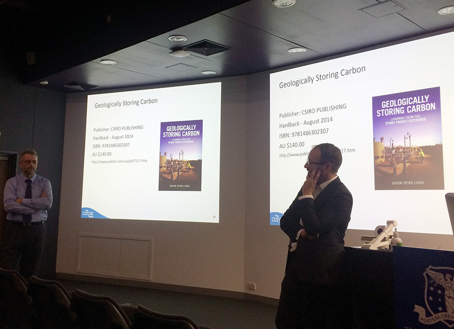
|
June 23, 2016
7.00pm-8.15pm |
Howitt Lecture
Location: Royal Society of Victoria, 8 La Trobe Street, Melbourne Talk by Erin Matchan (Melbourne University) The age of Victoria's volcanoes |
|
May 26, 2016
6.15pm |
Monthly GSAV meeting @ Melbourne University
Talk will be preceded by drinks from 5.30pm (tearoom, 4th floor). Talk starts at 6.15pm. Location: Fritz Lowe Theatre, School of Earth Sciences, University of Melbourne Talk by Titus Murray Hydrocarbon traps in complex settings |
|
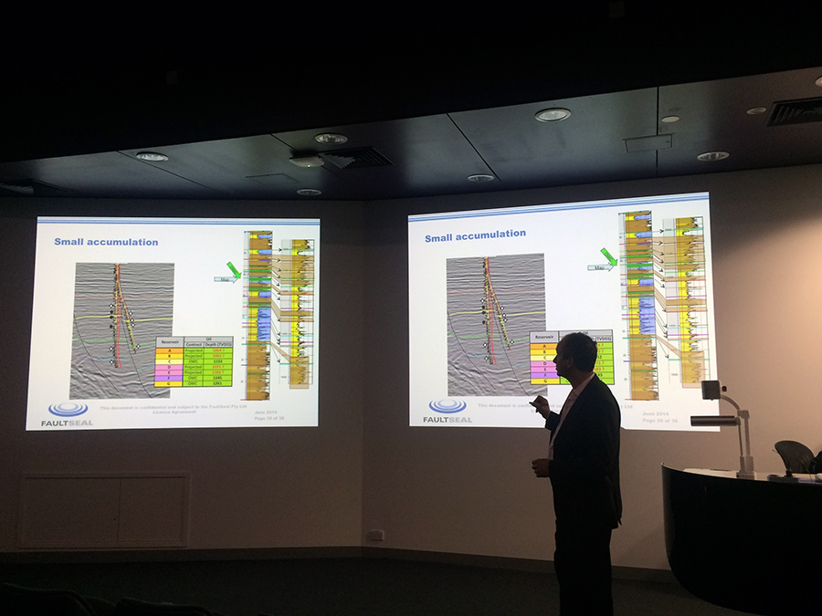
|
April 28, 2016
6.15pm |
Monthly GSAV meeting and Annual General Meeting (AGM) @ Melbourne University
Talk will be preceded by drinks from 5.30pm (tearoom, 4th floor). Talk starts at 6.15pm. Location: Fritz Lowe Theatre, School of Earth Sciences, University of Melbourne Talk by Dr Steven Micklethwaite (Monash University) Earthquakes with the Midas Touch?  Dr Steven Micklethwaite Dr Steven Micklethwaite
Abstract:
Earthquake-aftershock sequences and seismic swarms are self-organising phenomena. They play a potentially critical role in both fluid mass transfer through the crust and the formation of ore deposits. In this talk I will consider such processes and show how they can be used to predict the locations of gold deposits. Based on these principals, alongside a combination of field and experimental observations, it appears the duration of mineralization in orogenic-type systems may be extremely short (in the order of tens of thousands of years), which tallies with independent evidence showing the same for Carlin- and epithermal-type gold deposits. Bio:
Steven Micklethwaite (PhD Leeds) is establishing the Centre for Resource Science and Technology at Monash University, which will be an interdisciplinary and cross-institute initiative supporting the resources industry across the full mining workflow. Steven held previous postdoctoral and research positions at the Australian National University, as well as Australia's two leading minerals exploration research centres at the Universities of Tasmania and Western Australia. He feels very privileged to have been able to map on 4 different continents, and have an involvement in the commercialisation of the technique discussed in this talk. Photographs courtesy of Stefan A. Vollgger
|


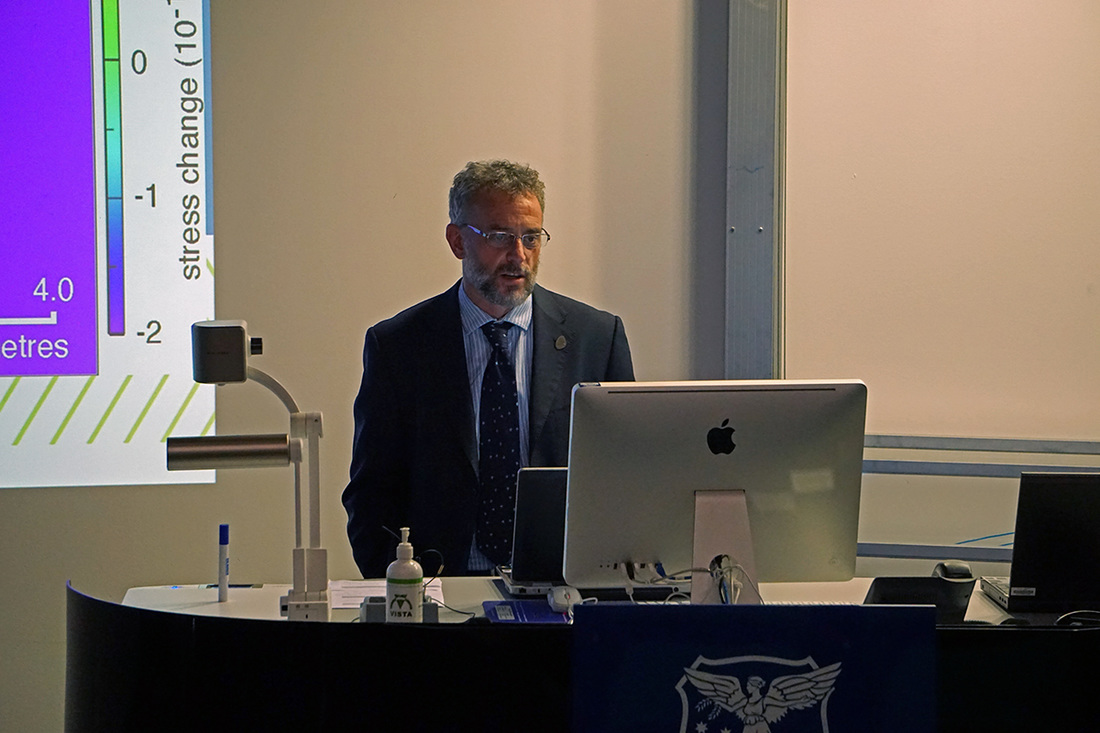
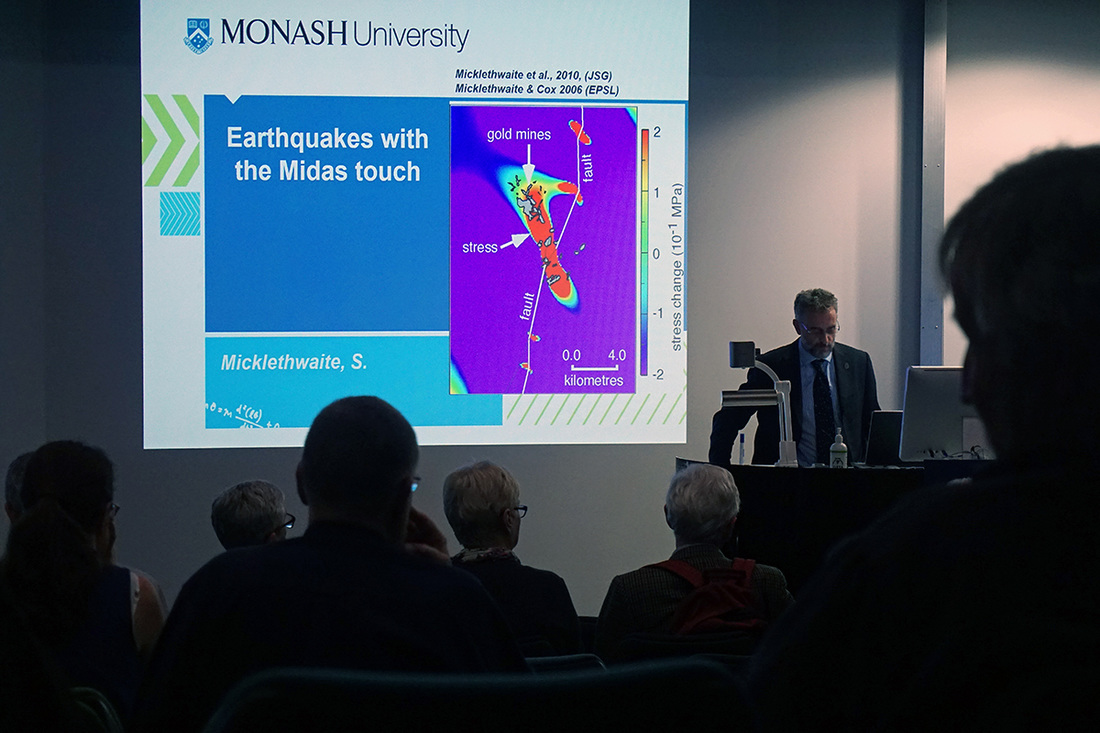


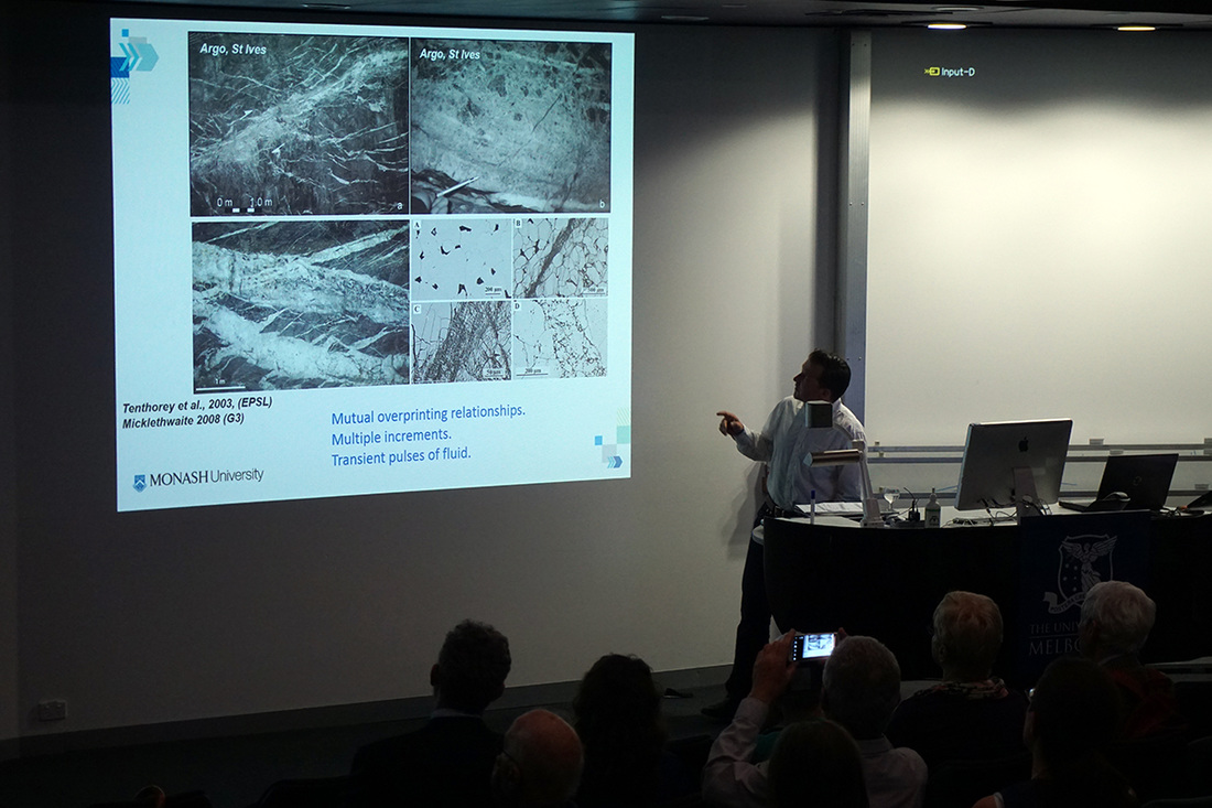
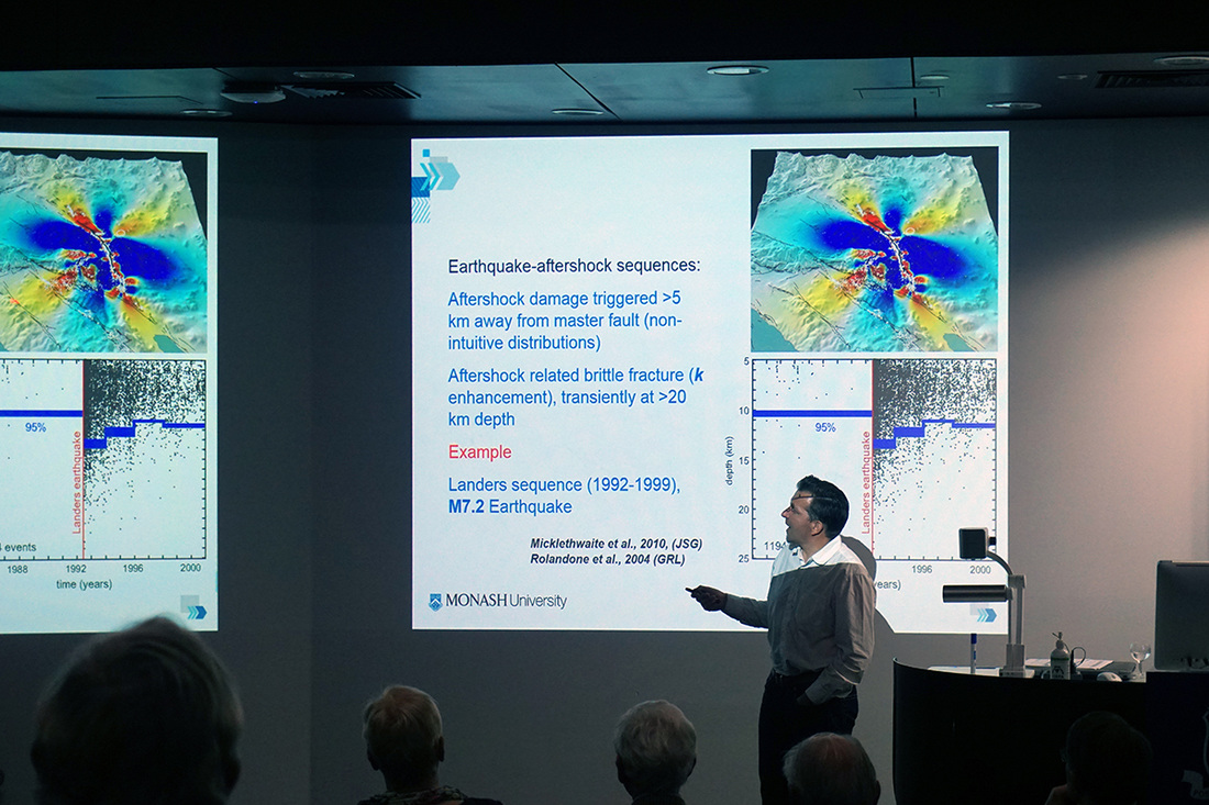
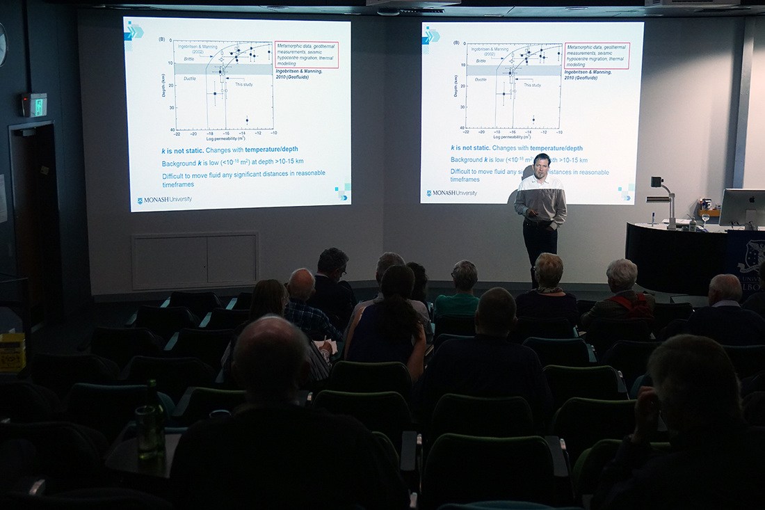
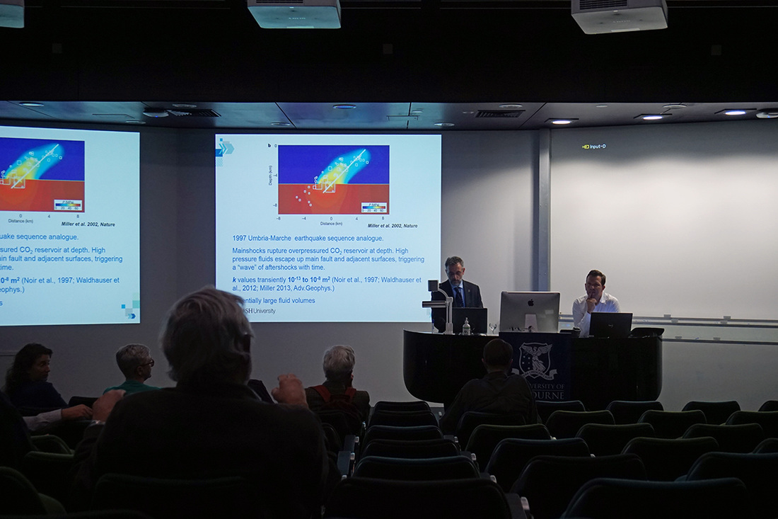
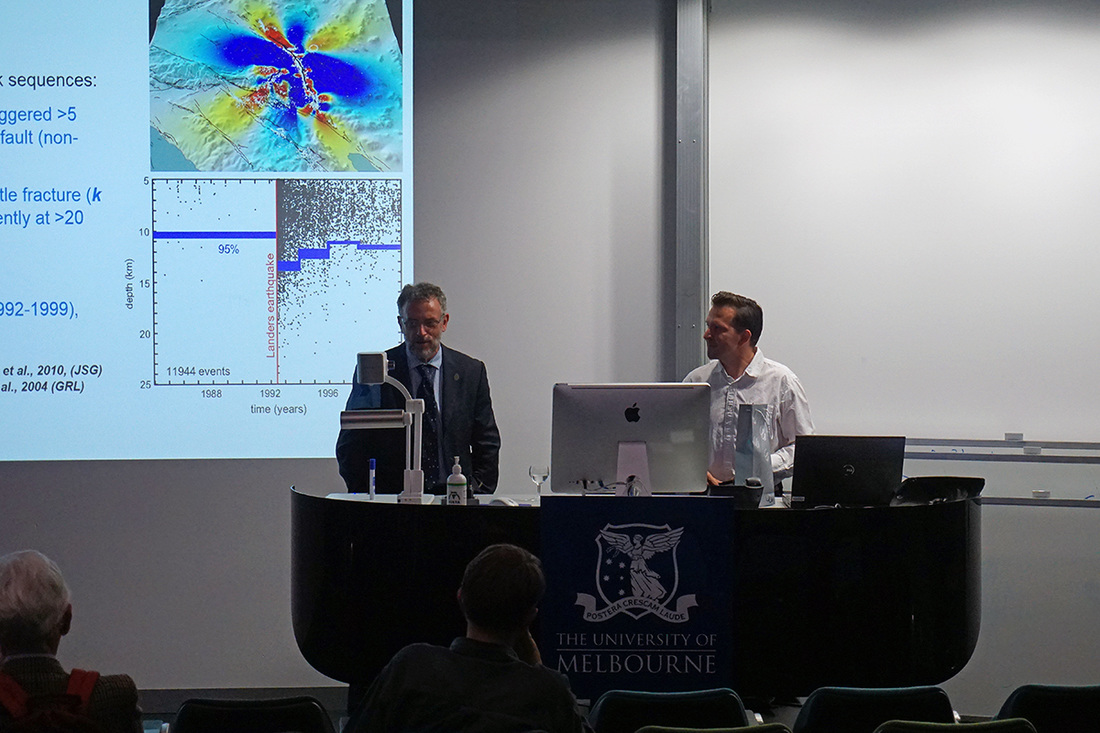
|
March 31, 2016
6.15pm |
Monthly GSAV meeting @ Melbourne University
Talk will be preceded by drinks from 5.30pm (tearoom, 4th floor). Talk starts at 6.15pm. Location: Fritz Lowe Theatre, School of Earth Sciences, University of Melbourne Talk by Prof Ian Cartwright (Monash University, 2015 GSAV Selwyn medallist) How old is stream water?  Prof Ian Cartwright Prof Ian Cartwright
Abstract:
Documenting the time over which rainfall is transmitted through catchments to streams is critical for the protection and management of river systems. The observation that many upland streams continue to flow over prolonged dry periods indicates there are stores of water in soils, weathered rocks, or fractures with residence times of at least a few years. A series of projects carried out at Monash has made use of the radioactive isotope tritium (3H) to estimate residence times of water in a number of Victorian streams. Tritium is generated in the atmosphere by the interaction of atmospheric gases with cosmic rays. Because of its half-life of 12.32 years and the fact that it forms part of the water molecule, it is ideal for estimating ages of waters that are up to 100 years old. Many upper catchment streams are fed by water that is a few years to several decades old and that even at high streamflowsmuch of the water in the stream is relatively old water displaced from within the catchment. These observations imply that these streams are buffered against rainfall variations on timescales of a few years (and most of these streams continued to flow through the 1996-2010 Millennium drought). However, the impacts of any changes tolanduse in these catchments or longer-term rainfall changes may take years to decades to manifest itself in changes to streamflow or water quality. Speaker bio (external link, opens in new window)
|
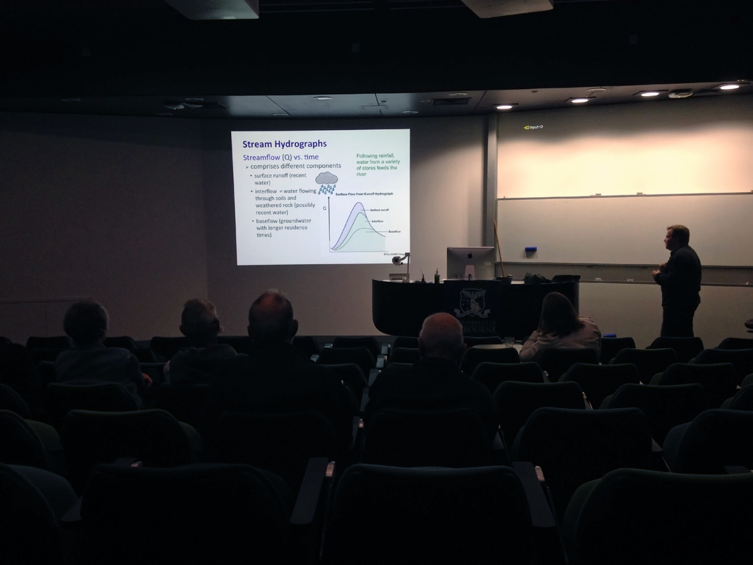

|
Feb 25, 2016
6.15pm |
Monthly GSAV meeting @ Melbourne University
Talk will be preceded by drinks from 5.30pm (tearoom, 4th floor). Talk starts at 6.15pm. Location: Fritz Lowe Theatre, School of Earth Sciences, University of Melbourne Talk by Prof. Lyal Harris (National Institute for Scientific Research, Canada) Non-plate tectonic interpretations for the Superior Craton, Canada, and Yilgarn Craton, Western Australia - exploration implications Abstract is available in the February 2016 GSAV newsletter (PDF). Speaker bio:
After undergraduate studies in geology and geophysics at the University of Melbourne and a period working as a geophysicist with Shell in Perth, Lyal completed M.Sc. and Ph.D. degrees in France in structural geology and tectonics. Lyal taught at the University of Western Australia between 1984 and 2000 and since 2003 has been a professor at the National Institute for Scientific Research (INRS-ETE) in Quebec City, Canada. He has consulted extensively and undertaken applied projects for mineral and petroleum exploration companies in diverse tectonic environments. His research integrates field structural studies, geophysical enhancement and interpretation, and analogue modelling applied to regional tectonics, controls on mineral deposits and, recently, deep geothermal energy. Research with his Geological Survey of Canada colleague, Jean Bédard, on new tectonic models for the Archaean with comparisons to the planet Venus was included in the top 10 scientific discoveries in Quebec Science for 2014 and was recognized in 2015 by a team research award from the Earth Sciences Sector of Natural Resources Canada. All photographs courtesy of Stefan A. Vollgger.
|
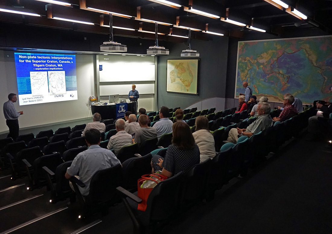
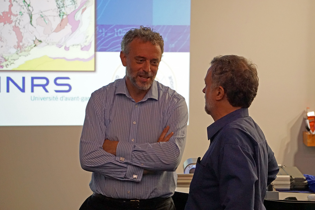


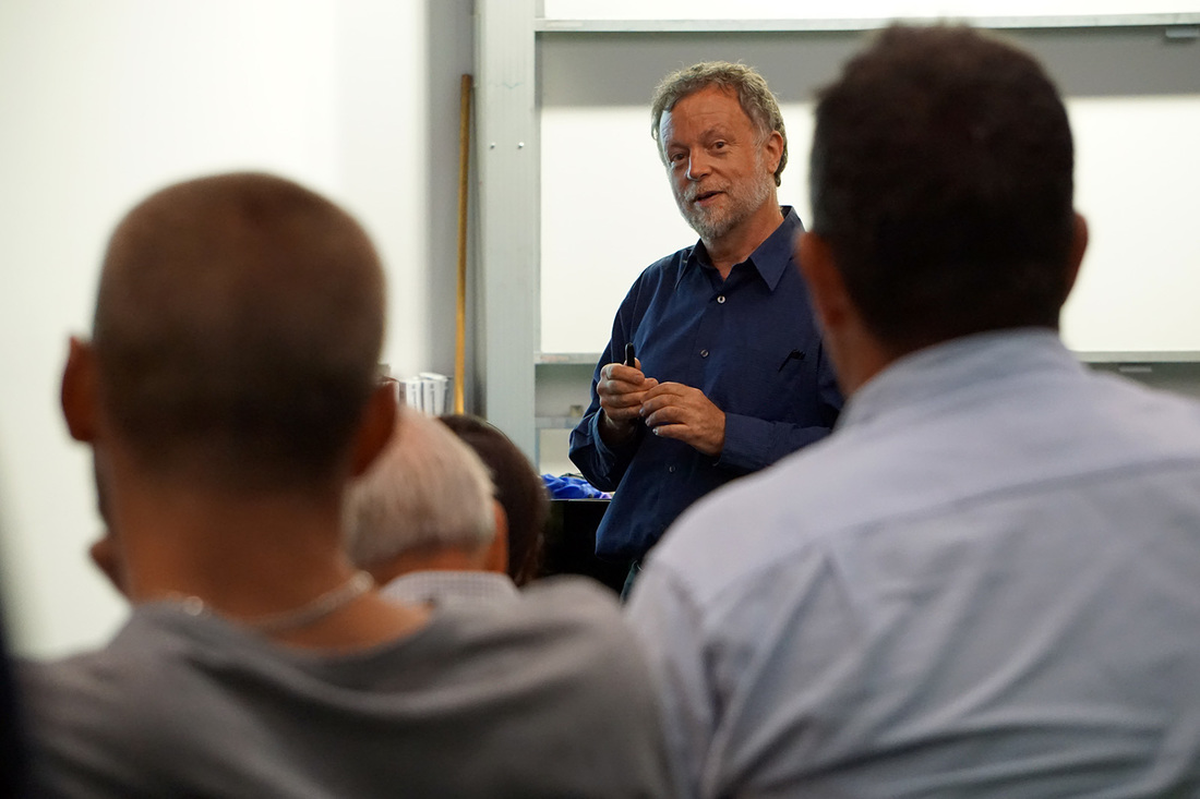
2015
|
Nov 26, 2015
6.15pm |
Monthly GSAV meeting @ Melbourne University
Talk will be preceded by drinks from 5.30pm (tearoom, 4th floor). Talk starts at 6.15pm. Location: Fritz Lowe Theatre, School of Earth Sciences, University of Melbourne Talk by Helen Green (Postdoctoral research fellow, School of Earth Sciences, The University of Melbourne) Dating, understanding and appreciating the Aboriginal Rock Art of the Kimberley Australia hosts one of the world’s largest, most varied and visually spectacular rock art treasures with hundreds of thousands of sites scattered throughout the country. Understanding, dating and appreciating this rock art is of huge importance to both Australians and the rest of the world, providing a history that goes much deeper than our shallow, colonial roots of the last few centuries.
To reinforce this broader understanding of heritage and identity, archaeologists, chemists, geologists, and physicists from the Universities of Melbourne, Western Australia and Wollongong, Archae-Aus consultancy, and the Australian Nuclear Science and Technology Organisation have embarked upon a 3 year project across the Kimberley region of northern WA, to date the rock art using an wide range of scientific techniques. Using these tools, this project aims to use the Kimberley rock art to provide primary evidence of how, when and why people first arrived in Australia. All photographs courtesy of Stefan A. Vollgger.
Tim Ziegler (Monash University) received the 2015 Frank Canavan award for for best second year student in Earth Sciences at a Victorian University.
Congratulations. |

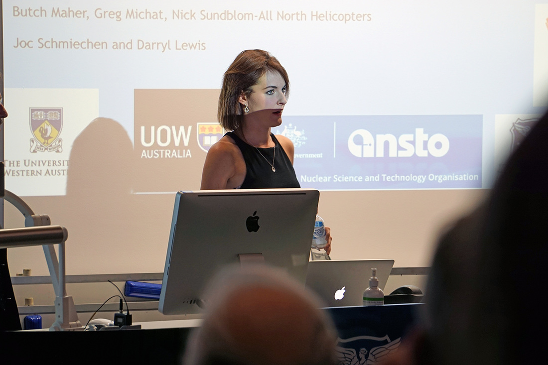


|
Nov 04, 2015
|
VUEESC 2015
Victorian Universities Earth and Environmental Sciences Conference Student conference, see www.earthsci.unimelb.edu.au/vueesc |
|
Oct 29, 2015
6.15pm |
Monthly GSAV meeting @ Melbourne University
Talk will be preceded by drinks from 5.30pm (tearoom, 4th floor). Talk starts at 6.15pm. Location: Fritz Lowe Theatre, School of Earth Sciences, University of Melbourne Talk by Rebekah Kurpiel Geochemical 'fingerprinting' of silcrete sources Preceding the talk, Professor Ian Cartwright (Monash University) received the 2015 Selwyn medal. The GSAV congratulates him to this great achievement. |
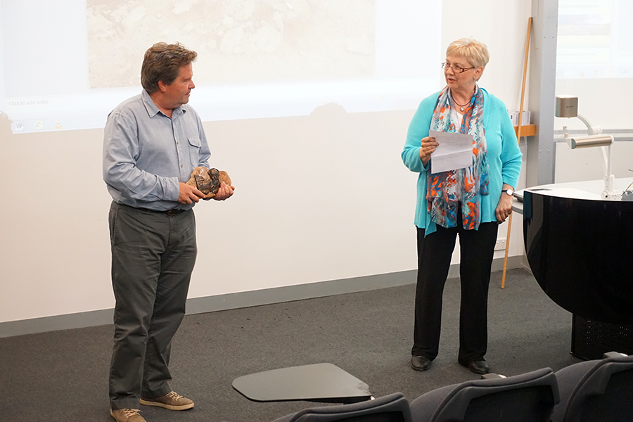 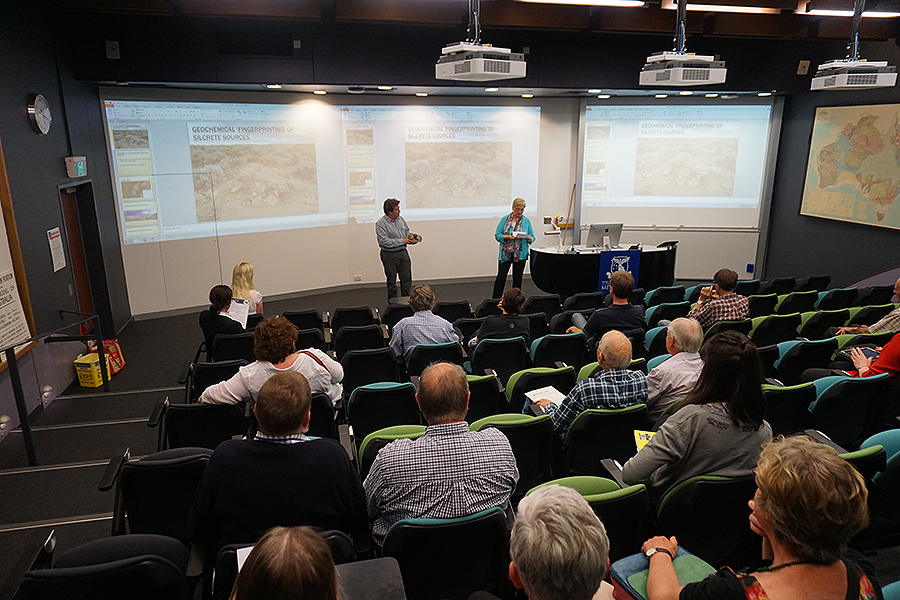 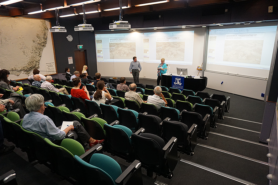  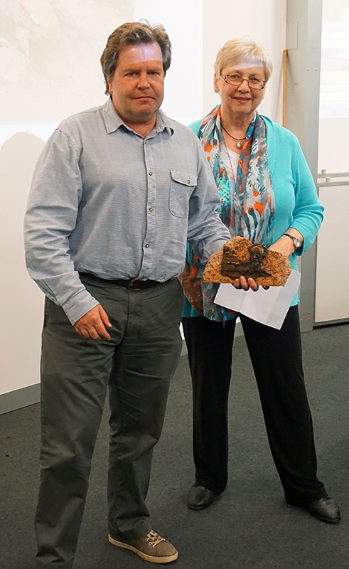  All photographs courtesy of Stefan A. Vollgger.
|
|
Sep 24, 2015
6.15pm |
Monthly GSAV meeting @ Melbourne University
Talk will be preceded by drinks from 5.30pm (tearoom, 4th floor). Talk starts at 6.15pm. Location: Fritz Lowe Theatre, School of Earth Sciences, University of Melbourne Talk by Robbie Rowe Australia's exploration potential: Is there anything out there to discover? Robbie Rowe bio: Over the last 10 years Robbie has also worked as an industry representative with government bodies, assisting to promote exploration activity, and with research institutions, contributing to the development of practical and applied research initiatives focused on next generation technologies for exploration. Within this theme Robbie recently (July 2015) completed an industry focused Roadmap for Exploration project with AMIRA International, looking at ways to improve exploration performance in covered terranes. In 2014 he founded NextGen Geological to provide strategic, management and technical advice to organizations associated with the metal resources industry, mining and exploration companies. Robbie is a Registered Professional Geoscientist in the field of Mineral Exploration with the AIG and a member of the AUSIMM and SEG. He is an Adjunct Senior Research Fellow at The University of Western Australia, School of Earth and Environment and also on the Executive and Geoscience Committees of UNCOVER (an initiative to focus Australia’s relevant geoscience effort on providing the knowledge base and technology to substantially increase the success rate of mineral exploration). |
|
Aug 27, 2015
6.15pm |
Monthly GSAV meeting @ Melbourne University
Talk will be preceded by drinks from 5.30pm (tearoom, 4th floor). Talk starts at 6.15pm. Location: Fritz Lowe Theatre, School of Earth Sciences, University of Melbourne Talk by Ken Grimes Editor of Helictite; Honourary Staff, School of Ecology, Environment and Evolution, La Trobe University Karst-like and Ruiniform features in Sandstones of Northern Australia |
|
July 30, 2015
6.15 PM |
Monthly GSAV meeting @ Melbourne University
Talk will be preceded by drinks from 5.30pm (tearoom, 4th floor). Talk starts at 6.15pm. Location: Fritz Loewe Theatre, School of Earth Sciences, University of Melbourne Student night Three students will be speaking at the July general meeting.
More details and abstracts can be found in the July 2015 GSAV newsletter (PDF).
|
|
June 25, 2015
6:15 PM |
|
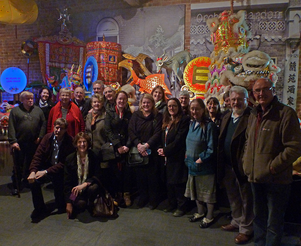
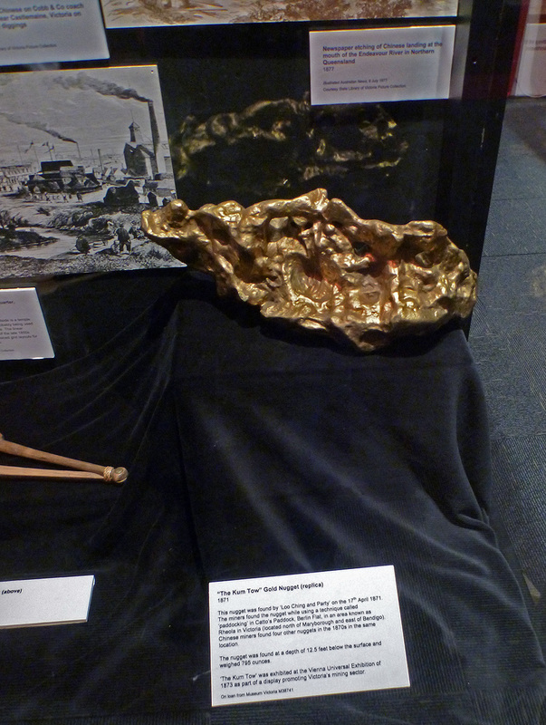
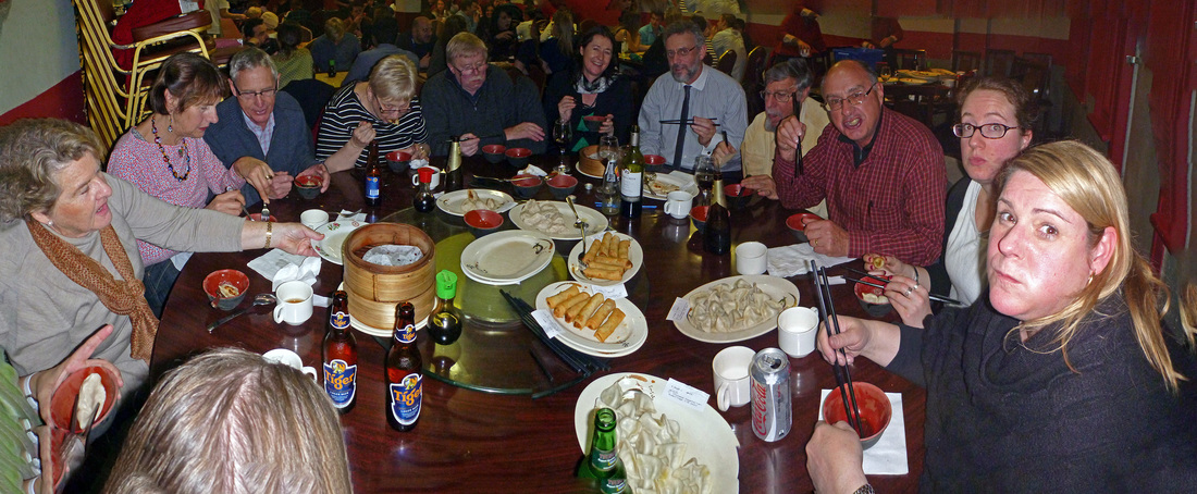


|
April 30, 2015
|
Monthly GSAV meeting @ Melbourne University
Talk will be preceded by drinks from 5.30pm (tearoom, 4th floor). Talk starts at 6.15pm. Location: McCoy-220 (Hills Lab), School of Earth Sciences, University of Melbourne Talk by Teagan Blaikie (Monash University) Three-dimensional potential field modelling of the subsurface morphology of complex maar volcanoes. Examples from the Newer Volcanics Province, Western Victoria
These anomalies were reproduced during modelling by shallow coalesced diatremes. Short-wavelength positive gravity and magnetic anomalies identified within the center of the craters suggest complex internal structures. Modelling identified feeder vents, consisting of higher proportions of volcanic debris, intrusive dykes, and ponded magma. Because potential field models are non-unique, sensitivity analyses were undertaken to understand where uncertainty lies in the interpretations, and how the models may vary between the bounds of the constraints. Rather than producing a single ‘ideal’ model, multiple models consistent with available geologic information are created using different inversion techniques. The modelling technique we present focuses on maar volcanoes, but there are wider implications for imaging the subsurface of other volcanic systems such as kimberlite pipes, scoria cones, tuff rings and calderas.
Teagan Blaikie bio:
Teagan Blaikie has recently completed her PhD in the fields of geophysics and volcanology at, Monash University in Melbourne. Her research involves integrating geologic and geophysical data to model the internal structures of volcanoes in order to understand and link their subsurface morphology with their eruptive histories. This research is based in the Newer Volcanics Province of Western Victoria, and has implications for understanding volcanism and assessing hazards associated with a future eruption in the region. |
|
March 26, 2015
|
Monthly GSAV meeting @ Melbourne University
Talk will be preceded by drinks from 5.30pm (tearoom, 4th floor). Talk starts at 6.15pm. Location: McCoy-220 (Hills Lab), School of Earth Sciences, University of Melbourne Talk by Fiona Glover (La Trobe University) Characterisation of acid sulphate soils in south-west Victoria, Australia
Fiona Glover bio: Fiona Glover is a PhD student at La Trobe University who submitted her thesis in December 2014. Prior to starting her PhD in 2009, she completed a Bachelor of Environmental Science in 2007, and her honours year in 2008, also at La Trobe University. Her honours project was also on inland acid sulfate soils, where she developed a fascination with various sulfide minerals. She considers herself lucky to have had the opportunities to work on such interesting environmental problems and contribute to a greater scientific understanding of them. |
|
Feb 26, 2015
|
First monthly GSAV meeting for 2015 @ Melbourne University
Drinks from 5.30pm. Meeting starts at 6.15pm. Location: Fritz Loewe Lecture Theatre, School of Earth Sciences / University of Melbourne. Talk by Graham Carr “Three decades of mineral exploration technology research – my top 5 (or 6)” Graham Carr bio:
Graham Carr was elected President of the Geological Society of Australia in July 2014. Earlier that month he had retired from CSIRO after 35 years as a researcher and research manager. He suspects he is at the older end of spectrum of GSA presidents – but is not going to check. Throughout his career he has been privileged to work closely with a host of colleagues in industry, in CSIRO, in geological surveys in AMIRA and in universities. As a geologist and geochemist his career has been dedicated to developing new geochemical technologies in mineral exploration – particularly the use of Pb isotopes in discriminating geochemical anomalies. He has lead numerous AMIRA and CSIRO projects and consultancies, most particularly SIROTOPE. and has been involved with 6 CRC’s and other major research initiatives. As a research manager he was involved with the whole spectrum of research in mineral exploration in CSIRO – among them 6 CRC’s and other major research initiatives such as AUSCOPE and UNCOVER. Before his retirement he was Chief Scientist of the Division of Earth Science and Resource Engineering. He remains a CSIRO Honorary Fellow and has aspirations to continue his Pb isotope research as well as maintaining a modest consultancy. It is an expectation of GSA presidents that they speak at each of the State Divisions, usually towards the end of their tenure. Graham has decided to inflict himself earlier rather than later, particularly to develop a dialogue with members around some of the challenges that the society currently faces. |
2014
|
Nov 27, 2014
|
Final meeting of 2014 @ Melbourne University
Drinks from 5.30pm. Meeting starts at 6.15pm. Speaker: Peter William Trusler Title: Illustrating for Science and Culture Location: Fritz Loewe Lecture Theatre, School of Earth Sciences / University of Melbourne. Despite the diversity of his interests in art and science, Peter Trusler will concentrate on a single fossil species from deep time as an example of his involvement in the multi-disciplinary approach of paleontological study. Rangea is the type genus of the Rangeomorpha, an extinct clade at the base of the evolutionary tree of large, complex organisms which prospered during the late Neoproterozoic. It represents an iconic Ediacaran taxon but the relatively few specimens previously known, significantly hindered an accurate reconstruction. The discovery and research on more than 100 new specimens of Rangea recovered from Farm Aar in southern Namibia since 2006, significantly expands this data set. Unravelling the fortuitous taphonomy and geochemistry that led to the well preserved internal and external features of these specimens allow new interpretations of Rangea morphology and lifestyle with significant implications for the understanding of the earliest processes in the evolution of metazoans. Peter William Trusler bio: Trusler is a Melbourne freelance artist and is a zoological science graduate from Monash University, Clayton. He holds a special interest in biological illustration and his work in this field is highly regarded internationally and features in numerous popular and scientific publications. These include: His first - Kloot and McCulloch, (1980), “Birds of Australian Gardens”. Rigby, Adelaide. (1980 Whitley Award, Best illustrated Book). His most recent - Rich, Vickers-Rich and Trusler, (2010), “The Artist and the Scientists”. Cambridge University Press, Melbourne. He has been twice awarded the Lanzendorf Paleo Art Prize by the Society of Vertebrate Paleontology; for scientific illustration in 2001 and for two-dimensional art in 2005. Trusler is a foundation member of the Wildlife Art Society of Australasia and his design work has featured on national philatelic issues and coins. His present involvement in international geological and biological research projects spans the geological record from the Ediacaran through to the Late Pleistocene. His original artwork was featured earlier this year in a joint exhibition from the American Museum of Natural History, San Juan National Science Museum and Monash University, held at the ArtScience Museum in Singapore. |
|
Oct 30, 2014
|
Monthly GSAV meeting @ Melbourne University
Drinks from 5.30pm. Meeting starts at 6.15pm. Speaker: Dr Anthony Harris Title: Architectural controls on Palaeozoic porphyry Au-Cu, Cadia Valley, NSW Location: Fritz Loewe Lecture Theatre, School of Earth Sciences / University of Melbourne. Anthony Harris bio: Anthony is Principal Geologist (Exploration) for Newcrest Mining Limited. He considers himself privileged to have spent the past 18 years working together with memorable geologists on world-class porphyry and epithermal deposits. He completed his undergraduate and postgraduate studies at the University of Queensland before commencing as a research fellow at the Centre of Excellence in Ore Deposits, University of Tasmania. It was here that he began work on the giant Cadia deposits, the subject of today’s presentation. This work that bring together industry and academic professionals led to his current role in Newcrest. |
|
Sep 29 - Oct 3, 2014
|
|
Aug 28, 2014
|
Monthly GSAV meeting @ Melbourne University
Speaker: Barbara Wagstaff Title: Dating Dinosaurs Location: Fritz Loewe Lecture Theatre, School of Earth Sciences / University of Melbourne |
|
July 31, 2014
|
Monthly GSAV meeting and STUDENT NIGHT @ Melbourne University
Students who have been sponsored by the GSAV in the past year to attend conferences will be presenting an aspect of their research. All speakers are PhD candidates at their respective universities. Farah Ali - Environmental Geoscience, La Trobe University Caitlin Gionfriddo - Biogeochemistry, The University of Melbourne Estephany Marillo Sialer - Geochemistry, The University of Melbourne Stefan Vollgger - Economic Geology, Monash University See July 2014 newsletter (PDF) for abstracts. Location: Fritz Loewe Lecture Theatre, School of Earth Sciences / University of Melbourne |
|
June 26, 2014
|
Monthly GSAV meeting @ Melbourne University
Speaker: Prof David Cantrill Title: Biology, molecules and geology biogeography in the southwest Pacific (Zealandia) Location: Fritz Loewe Lecture Theatre, School of Earth Sciences / University of Melbourne |
|
May 29, 2014
|
Dr Twycross speaking on the pioneering work in seismography of John Milne.
The talk was followed by a Night Sky Tour. Location: Mueller Hall in the National Herbarium of Victoria (Royal Botanical Gardens, Melbourne) |
